maine's white mountains
Getting out into a true wilderness in Maine is closer than you think. Welcome to Maine’s White Mountains and section of the White Mountain National Forest, an unspoiled destination that beckons adventurers and nature lovers alike. This captivating part of Maine’s Lakes and Mountains, located 90 minutes by car from Lewiston and Auburn, offers an immersive wilderness experience.
With its rugged terrain, pristine lakes, dense forests, and the Caribou-Speckled Mountain Wilderness area, visitors can explore the vast network of trails, enjoy backwoods camping, discover hidden waterfalls, and encounter diverse flora and fauna. The area’s well-maintained trails offer nature enthusiasts an opportunity to spot majestic moose or elusive black bears. Birders will revel in the areas many bird species. With crystal-clear lakes and babbling brooks, the area also offers excellent fishing, kayaking, and swimming opportunities. Numerous campgrounds are scattered throughout the wilderness for visitors to spend more time here.
If you plan to travel to the Caribou-Speckled Mountain Wilderness, we encourage you to check with the Androscoggin Ranger Station for current information about winter road and trail closures, maximum group size, as well as camping and fire regulations. A White Mountain National Forest Recreation Pass is required at the Brickett Place Day Use Area, a self-serve pay station is located on site. Hikers should take notice of narrower trails and fewer signs within the Wilderness area. The trail is not well marked within the wilderness area, so downloading the map ahead of time is recommended.
must visit spots
evans notch
As the easternmost notch through the White Mountains, just a mile from the state line, Evans Notch serves as the epicenter for this part of the White Mountains National Forest for hikers and climbers looking to explore the hundreds of miles of trails and thousands of miles of spectacular views.
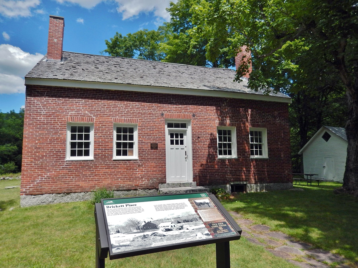
From the undulating and woodsy curves of SR 113, which gives passage to Gilead and beyond, to the tidy Brickett Place—an early 1800s homestead that serves as a jumping-off point for many hiking adventures here. To the benefit of those who frequent the area and those who may just be passing through, this place never seems to make it onto the radar of the crowds, which makes it all the more enticing for the lucky visitor.
Caribou Mountain
Along Morrison Brook, hikers will pass several cascade falls punctuating the brook, with the finest being Kees Falls, dropping 25 feet to an ancient green pool that only the brave should try to access. Several streams cross the trail on the ascent.
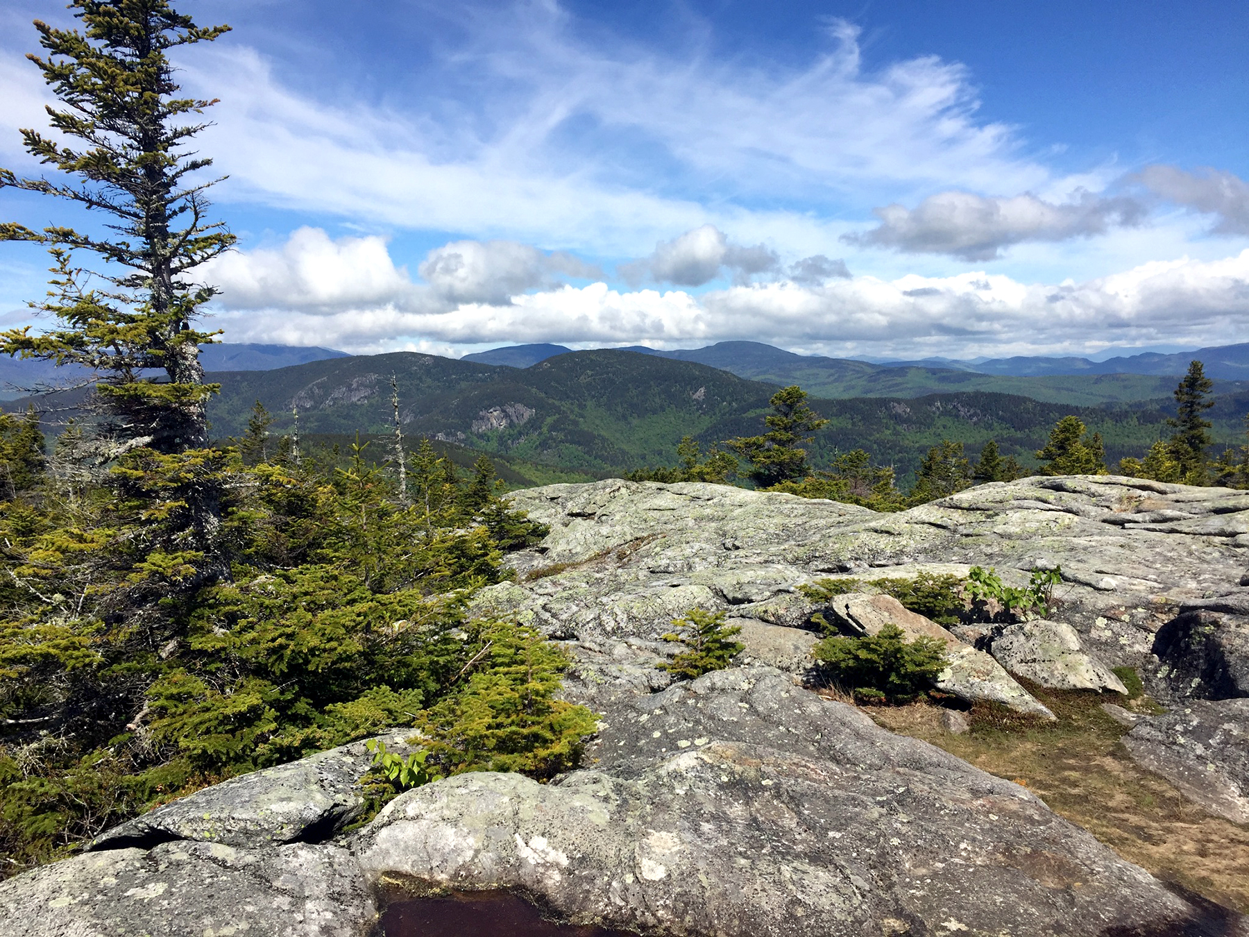
Eventually, the steady climb transitions to a sloped rise that arrives at the summit. Cl mbers are greeted by a spectacular sweeping view of the Caribou-Speckled Wilderness Area, the Mahoosucs, the Presidentials, Bethel and its surrounding Androscoggin River valley. The area above the tree line on Caribou feels almost table-like, and there are cairns along the way to keep hikers on the right path. Descending hikers should expect the Mud Brook Trail to be true to its name, being often muddy and wet.
Speckled Mountain
To say the very least, Bickford Brook Trail up Speckled Mountain is no ordinary walk in the woods. Departing from Brickett Place, the trail offers photographers several chances to capture images of waterfalls and other watery wonders along the way.
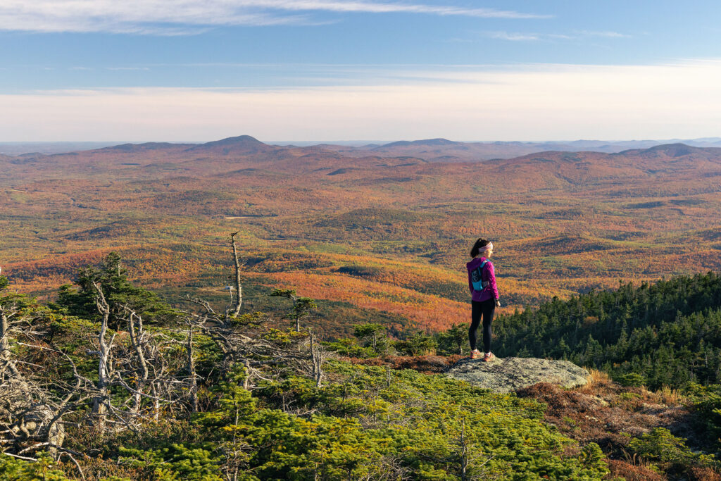
For many, these attractions, along with the extensive view at the top, are worth the price of admission. There are several lookout points and a memorable summit view. Features to look for include the Presidential Range and Kezar Lake to the east. Note that the the trip down can be muddy and slick in places, but if you take Bickford Brook Trail all the way down, you can also enjoy the Bickford Slides (either for a quick dip or from the end of your camera lens) before heading home.
the area's other mountains
East Royce Mountain
North and South Baldface
Summits 3,610 and 3,560 feet | views of the Mount Washington Weather Station
The Roost
Summit 1,374 feet | views of Carter-Moriah Range and the Wild River Valley | great Fall foliage hike
Blueberry Mountain
Summit 1,781 feet | 4-mile loop via White Cairn and Stone House trails | moderate hike difficulty
Ways to Adventure
On the trail
hiking
Maine’s Lakes and Mountains is filled with spectacular ways to hit the trail. Whether it is remote backcountry hiking, hoofing it up to the summit of Jockey Cap for the views, or just a leisurely walk in the woods, we’ve got a trail for you.
On the trail
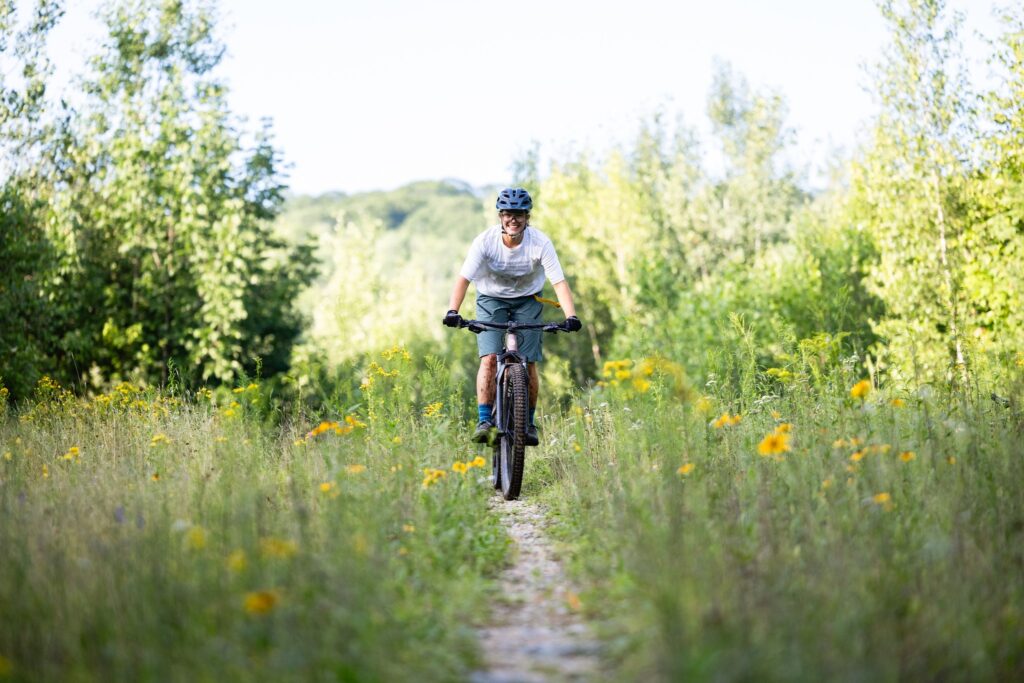
Mountain Biking
Though you do not have to be in the mountains to enjoy this sport, the Maine’s Lakes and Mountains region offers the perfect setup for bikers looking for the challenge of single-track.
On the trail
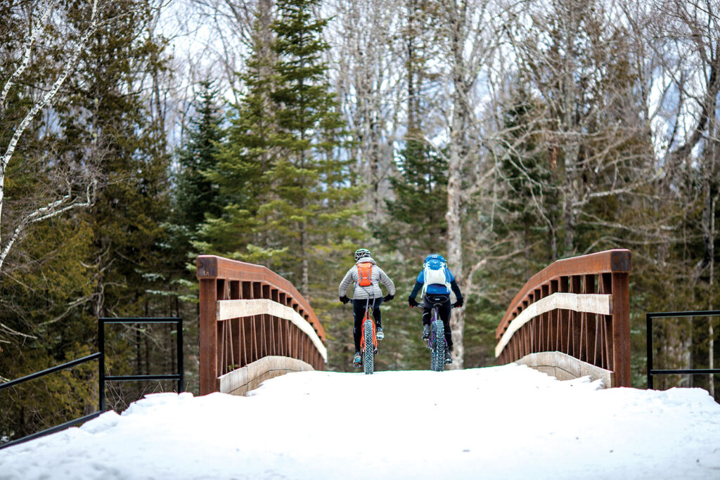
fat Biking
If you love mountain biking and winter, fat biking might be your new favorite sport. Fat bikes use huge, grippy tires that allow riders to take to trails typically used by snowmobilers and cross-country skiers.
On the trail
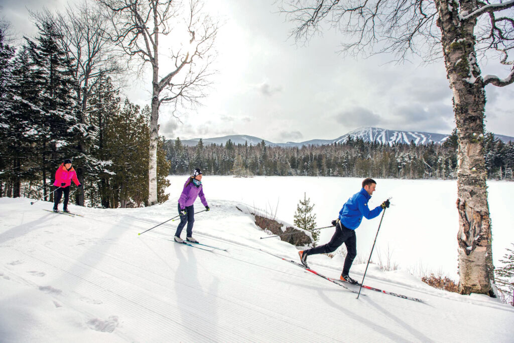
Nordic Skiing
On a crisp, sparkling winter day, one of the best ways to take in Maine’s Lakes and Mountains snowy landscape is to venture out on cross-country skis.
On the trail
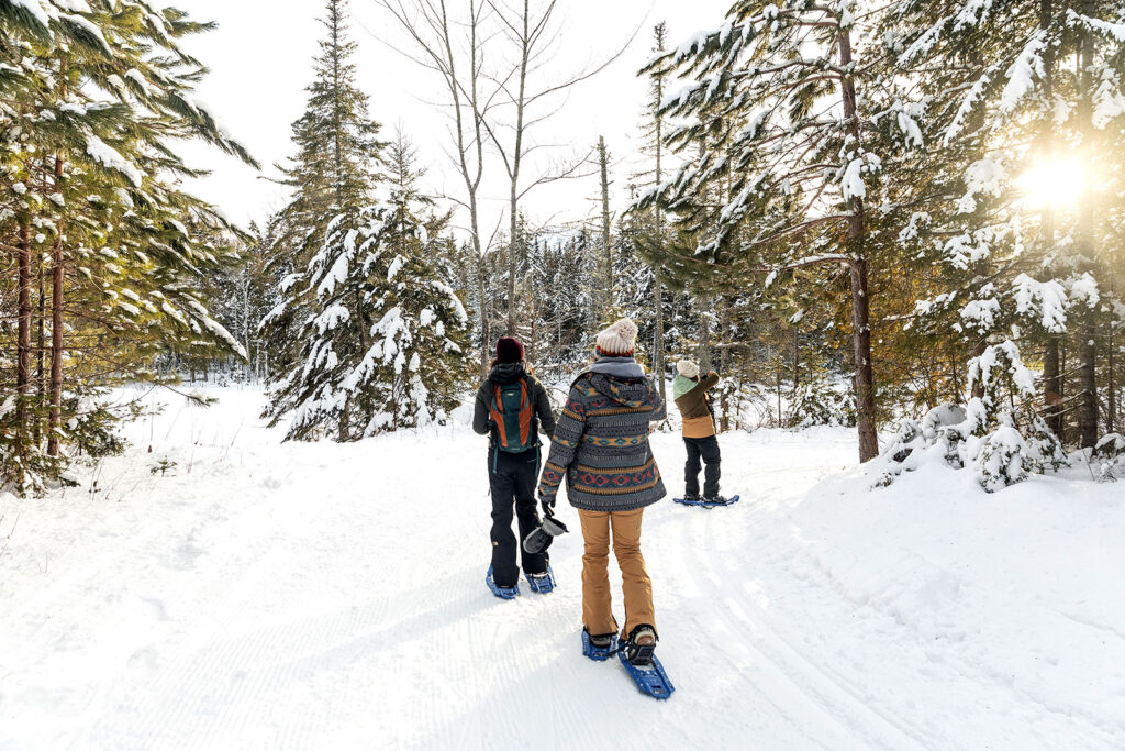
snowshoeing
Snowshoeing enthusiasts have options lots of options here. With over 250-miles of groomed trails across the region
On the trail
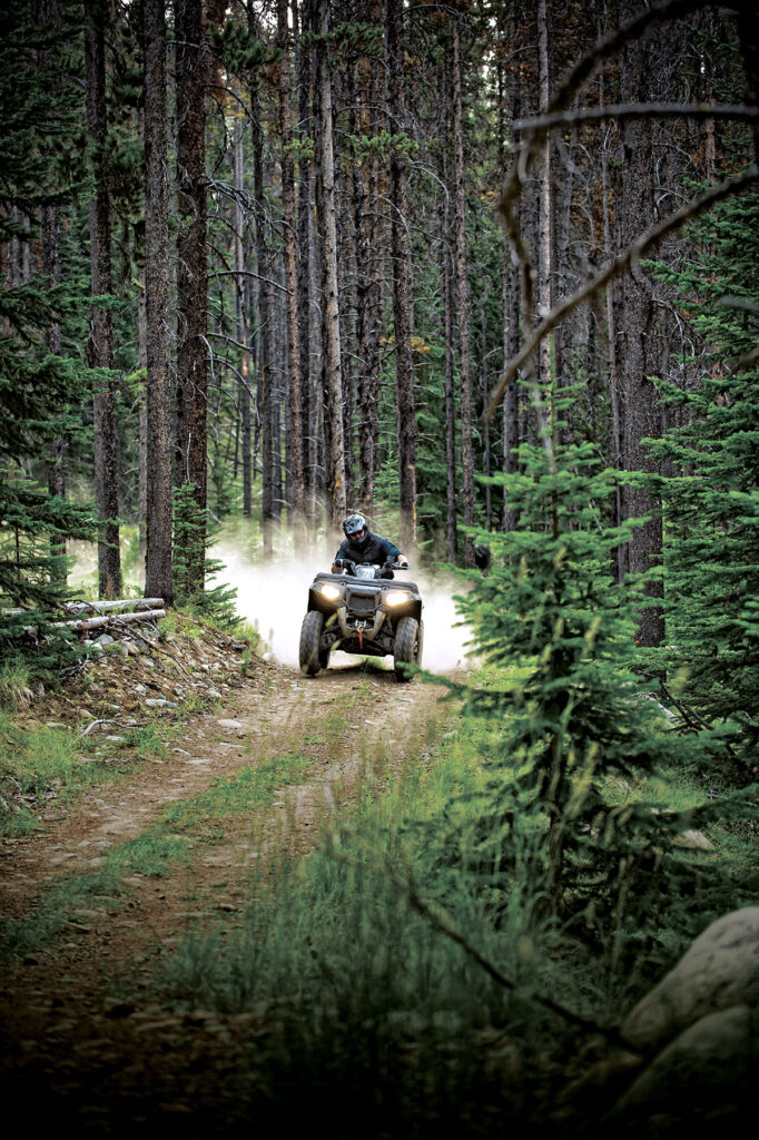
ATV Riding
Take on terrain from rocky climbs up a mountain, to smooth cruises through open plains as you explore extensive miles of ATV trails spanning mountains, forests, and meadows.
On the trail
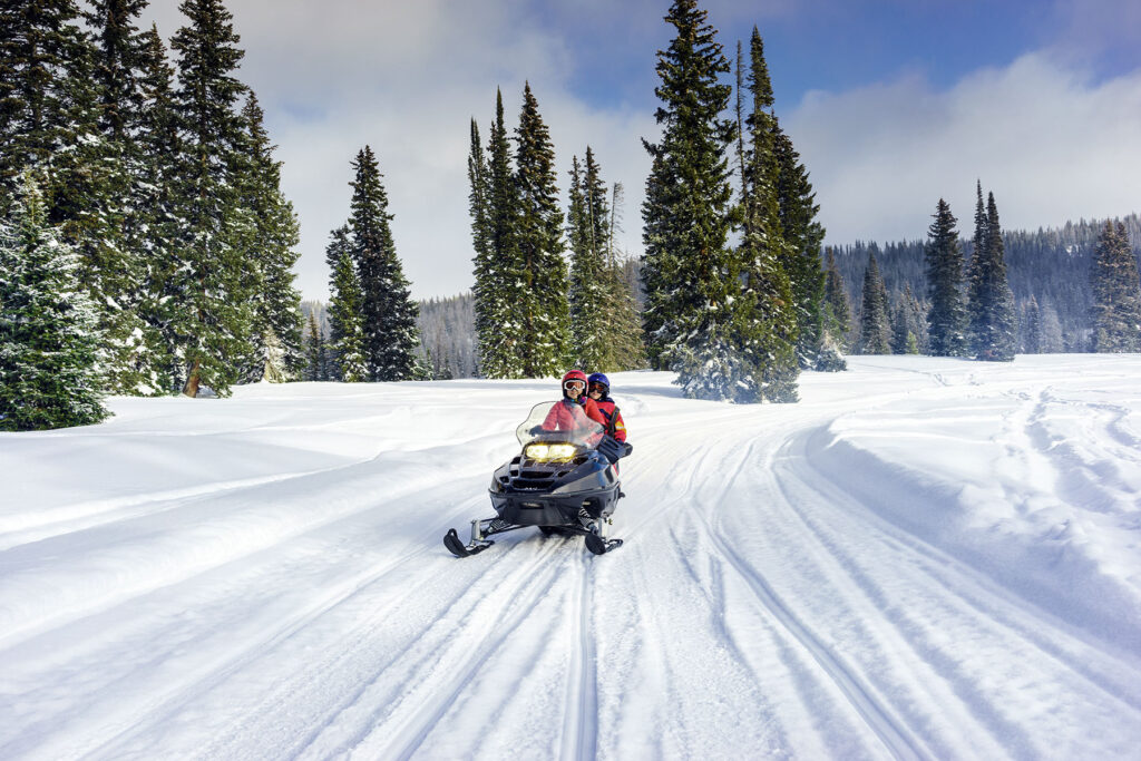
snowmobiling
With over near-endless miles of groomed trails maintained by local riding clubs, you’ll always find new places to explore amid the incredible scenery, fragrant pine forests, and wide-open plains.
Nature and Wildlife
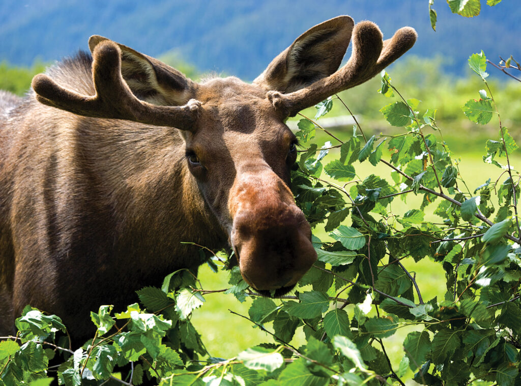
Moose Spotting
You can spot moose throughout most of Maine, but their population is most significant in more secluded areas, including much of Maine’s Lakes and Mountains.
Nature and Wildlife
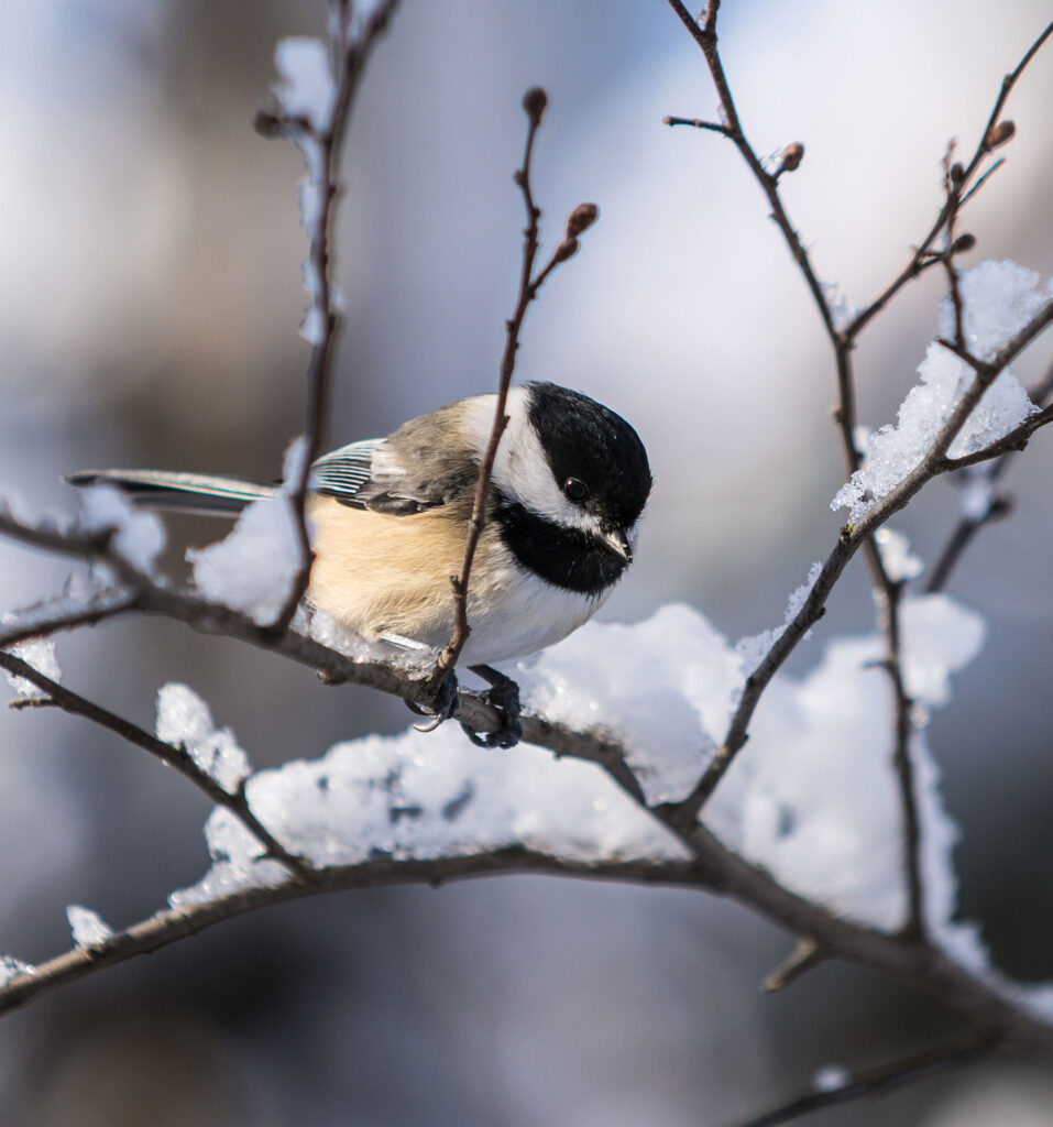
birding
The forests, fields, and wetlands of Maine’s Lakes and Mountains are the ideal setting to experience the thrill of birdwatching. Many highly coveted species can be found in the area’s boreal forests, including woodpeckers and Bicknell’s Thrush.
Plan Your Trip
Maine’s Lakes and Mountains offers a variety of resources to help you plan your next visit, including an annual visitor’s guide, stand alone map, and the new Adventure Guide App.
Visitor's Guide
Our Free Visitor's Guide will help inspire your next adventure along our mountain trails, lakes, scenic byways, bustling towns and more.
Map of the Region
Companion to the Visitor Guide, our dual-sided planning map will help you find your way to adventure in every season throughout the region.
Adventure Guide App
The App will point the way to all kinds of adventures, experiences and destinations in Maine’s Lakes and Mountains with GPS location maps and alerts.
Adventure Respectfully
Our lakes, mountains, and forests are worthy of respect. Whether you’re venturing out into our vast public or private lands or parks, here’s what you can do to conserve the area’s natural resources for all.
other resources
Take Care of the Land
Tread lightly and leave no trace. Keep this place as pristine as you found it.
Where ya headed?
Check if you’ll be on public or private land and if there are any restrictions or fees. Always research your destination ahead of time.
Stick to established trails & roads.
Whether hiking, biking, angling, or ATVing, always stay on a designated trail.
DON’T DAMAGE TREES
To protect the forest, only build fires in approved sites, don’t leave them unattended, and extinguish them thoroughly.
Avoid spreading invasive species.
Don’t transport firewood, brush your boots, and wash and dry your boat before heading to your next adventure.
Avoid peak hours
Plan around peak hours midday to avoid crowds. Have a Plan B in case the parking lot is already full.
No litterbugs allowed
If you pack it in, pack it out, including food waste like apple cores. Bring bags for pet waste.
When nature calls
If you have to go, pick a spot at least 100′ off the trail or away from a body of water, and bury your poop 6″ deep.