peakbagging
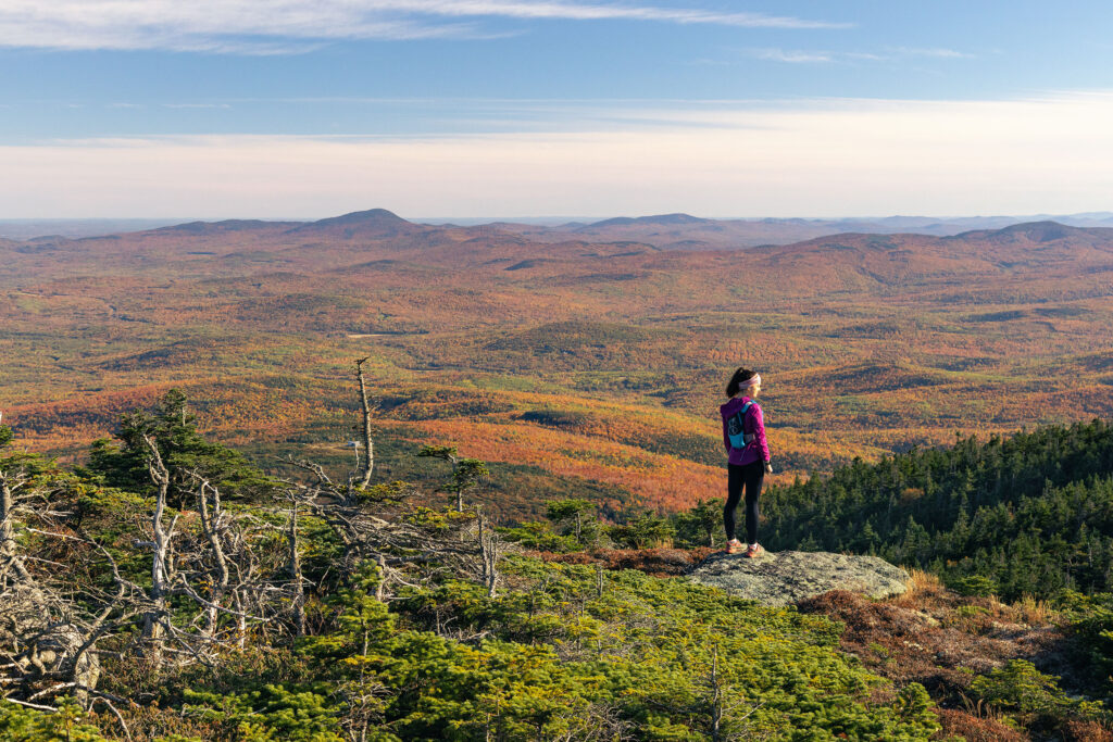
If you love to bag peaks, you’re going to be thrilled when you visit Maine’s Lakes and Mountains. Boasting the state’s highest concentration of mountain peaks over 4,000 feet, baggers come here to summit as many as possible.
But what is a Peakbagger? According to Greg at Peakbagger.com a Peakbagger is a mountain climber whose principal goal is the attainment of a summit, or a specific set of summits.
For many hikers, few things are more rewarding than standing atop a mountain after a challenging trek and reveling in the reward of a stellar view. In Maine’s Lakes and Mountains region, peak baggers will find an abundance of peaks to challenge their stamina and reward their souls. Just be aware that climbing mountains in western Maine can be a risky pursuit thanks to fast-changing conditions and frequent storms. Always summit early, carry appropriate gear, and turn back if conditions get dicey.
Whether you’re looking for an easier summit to check off your list or a challenging, grueling climb, you’re sure to find it in one of the favorite high-peak hikes in western Maine highlighted here.
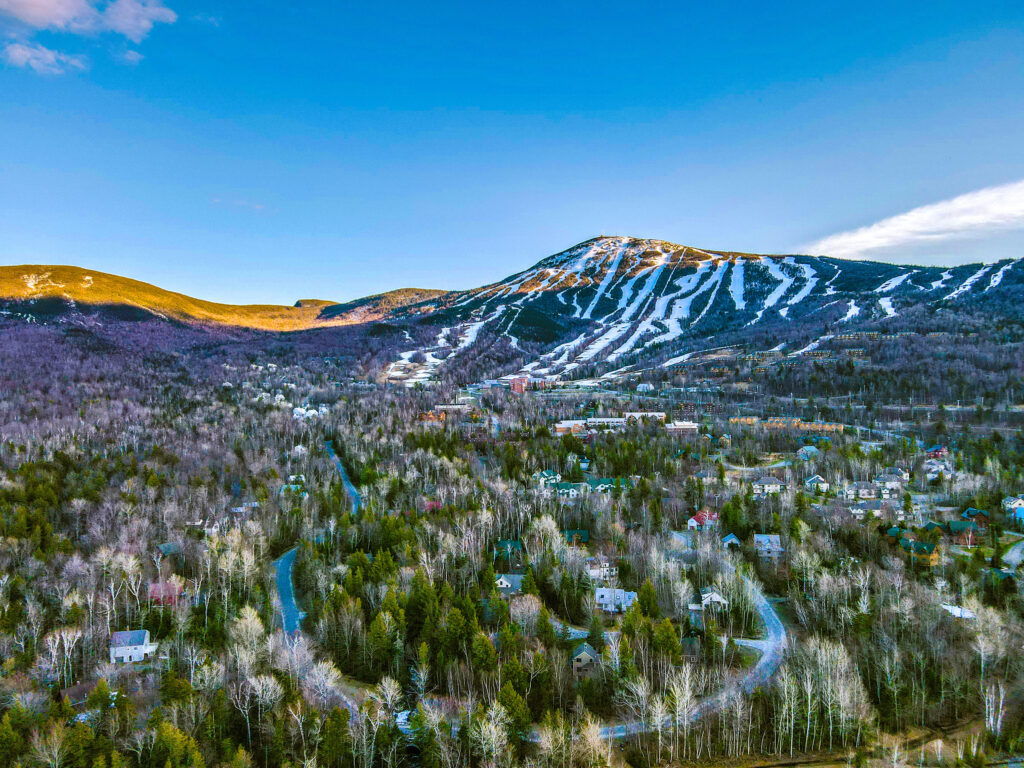
Sugarloaf Mountain
Elevation: 4,240 feet Distance: 6.4 miles round trip
Most peak baggers in Maine have Sugarloaf Mountain on their bucket list. While Sugarloaf is best known for its skiing, it’s a perfect summer summit after snow melts and accessible via the famed Appalachian Trail. Take Caribou Pond Road (AKA Caribou Valley Road) to reach its junction with the Appalachian Trail. (Take note, the conditions of Caribou Pond Road can vary significantly due to lack of maintenance and weather.)
On the AT, you’ll cross the Carrabassett River and then begin the real work with a 0.75-mile, 800-foot climb on a rocky ledge outcropping. Once you’re beyond this section, you’re exposed to the elements (bring a rain jacket) and are treated to views of the Carrabassett Valley. Continue on the AT to hike the final half-mile through a rugged, rocky forest. After 2,229 feet of elevation gain, enjoy surrounding mountain views from the top before returning the way you came.
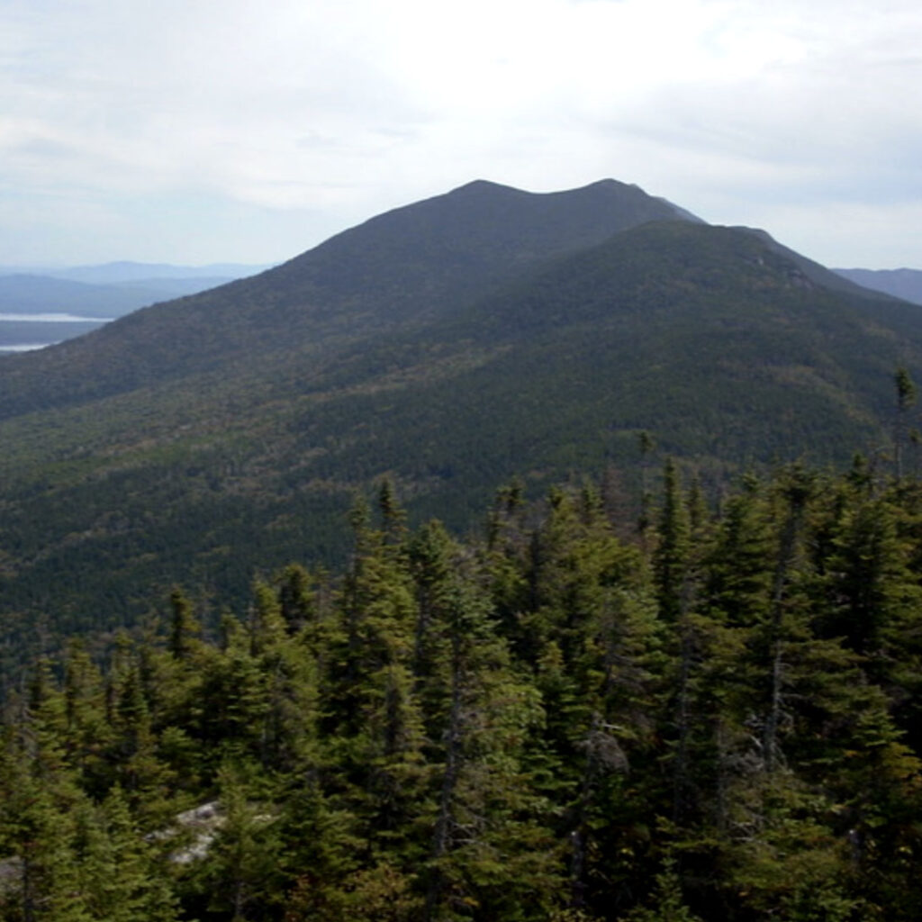
Crocker Mountain and South Crocker Mountain
Elevation: Crocker 4,228 feet, South Crocker 4,050 feet Distance: 5.2 miles round-trip
Check Maine’s third and fourth highest peaks off your list at Crocker Mountain in the Carrabassett Valley near Stratton. The only trail to the summit here is the Appalachian Trail, which can be accessed via the easier Caribou Pond Road (aka Caribou Valley Road) approach or Maine State Route 27.
Beginning at Caribou Pond Road, you’ll find the trip up South Crocker is relatively easy, compared to the ascent up other 4,000-foot peaks in Maine. The trail climbs 2,800 feet over 5.2 miles and offers a gradual incline that’s very doable. For a bonus peak, take a one-mile connector trail to Crocker Mountain, and then retrace your steps to return to your vehicle.
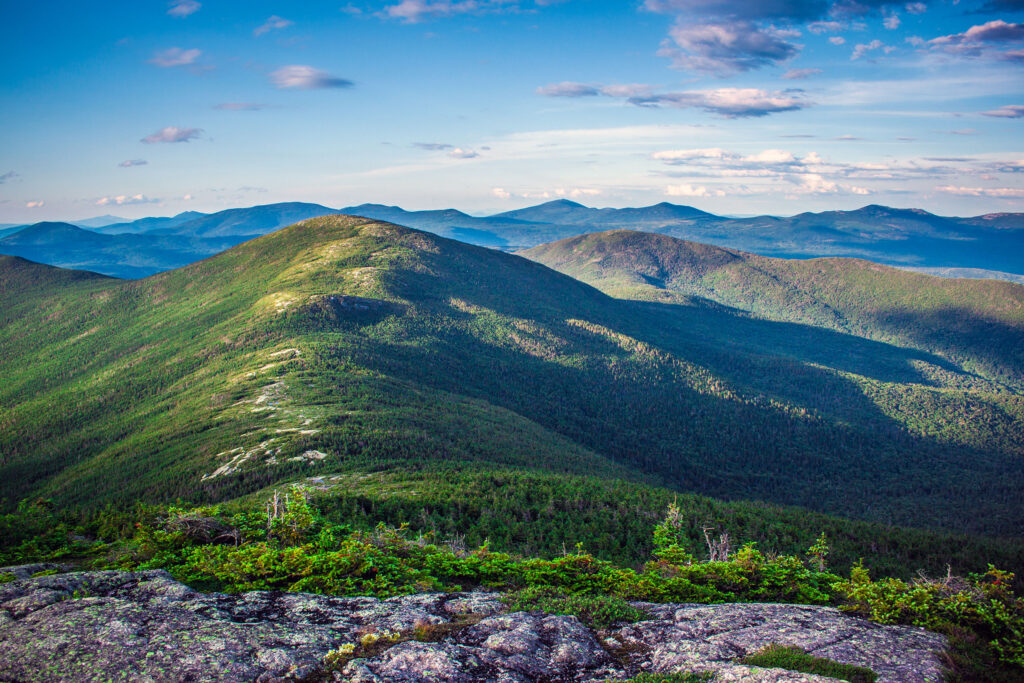
Saddleback Mountain
Elevation: 4,116 feet Distance: 4 miles round trip
This 4,116-foot peak is a fun summit with views of Rangeley Lakes, Saddleback Lake, and Winship and Conant Streams on a clear day. In summer, most take the Grey Ghost Trail from the base of Saddleback Mountain to bag this peak. Follow the line of a green chairlift up before connecting to the AT for an easy amble to the wide-open summit and panoramic views of the lakes below.
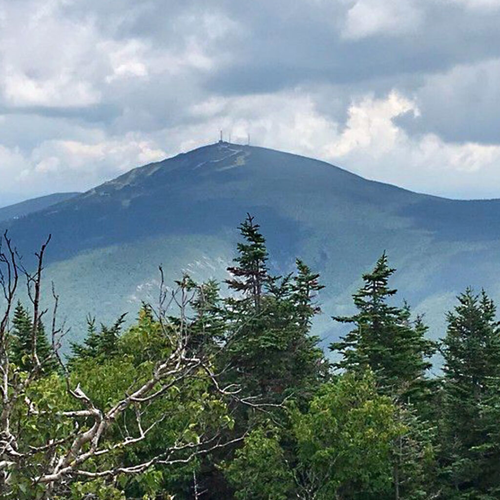
Mount Abraham
Elevation: 4,049 feet Distance: 8 miles round trip
Playing host to the second largest alpine zone in Maine (after the granddaddy of Mount Katahdin), the bald summit of Mount Abraham is easy to spot on a clear day from the base and is found near the town of Kingfield. To hike it, follow the challenging Mount Abraham Trail (also known as the Fire Warden’s Trail) for four miles to the summit.
Expect a gradual climb for the first two miles through the forest to the site of an old, burned-down ranger cabin. You’ll then face a steeper trek for the final two miles. Lush forest, river crossings, and rocky trails continue before opening to vistas of neighboring peaks. Follow the rock cairns to stay on-trail for the final scramble to the summit where an old fire tower and windy conditions mark the spot. If you pay close attention, you’ll also see a neat stone shelter built right into the talus.
Adventure Respectfully
Our lakes, mountains, and forests are worthy of respect. Whether you’re venturing out into our vast public or private lands or parks, here’s what you can do to conserve the area’s natural resources for all.
other resources
Take Care of the Land
Tread lightly and leave no trace. Keep this place as pristine as you found it.
Where ya headed?
Check if you’ll be on public or private land and if there are any restrictions or fees. Always research your destination ahead of time.
Stick to established trails & roads.
Whether hiking, biking, angling, or ATVing, always stay on a designated trail.
DON’T DAMAGE TREES
To protect the forest, only build fires in approved sites, don’t leave them unattended, and extinguish them thoroughly.
Avoid spreading invasive species.
Don’t transport firewood, brush your boots, and wash and dry your boat before heading to your next adventure.
Avoid peak hours
Plan around peak hours midday to avoid crowds. Have a Plan B in case the parking lot is already full.
No litterbugs allowed
If you pack it in, pack it out, including food waste like apple cores. Bring bags for pet waste.
When nature calls
If you have to go, pick a spot at least 100′ off the trail or away from a body of water, and bury your poop 6″ deep.
Ways to Adventure
On the trail
hiking
Maine’s Lakes and Mountains is filled with spectacular ways to hit the trail. Whether it is remote backcountry hiking, hoofing it up to the summit of Jockey Cap for the views, or just a leisurely walk in the woods, we’ve got a trail for you.
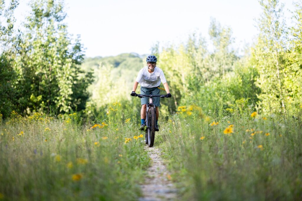
On the trail
Mountain Biking
Though you do not have to be in the mountains to enjoy this sport, the Maine’s Lakes and Mountains region offers the perfect setup for bikers looking for the challenge of single-track.
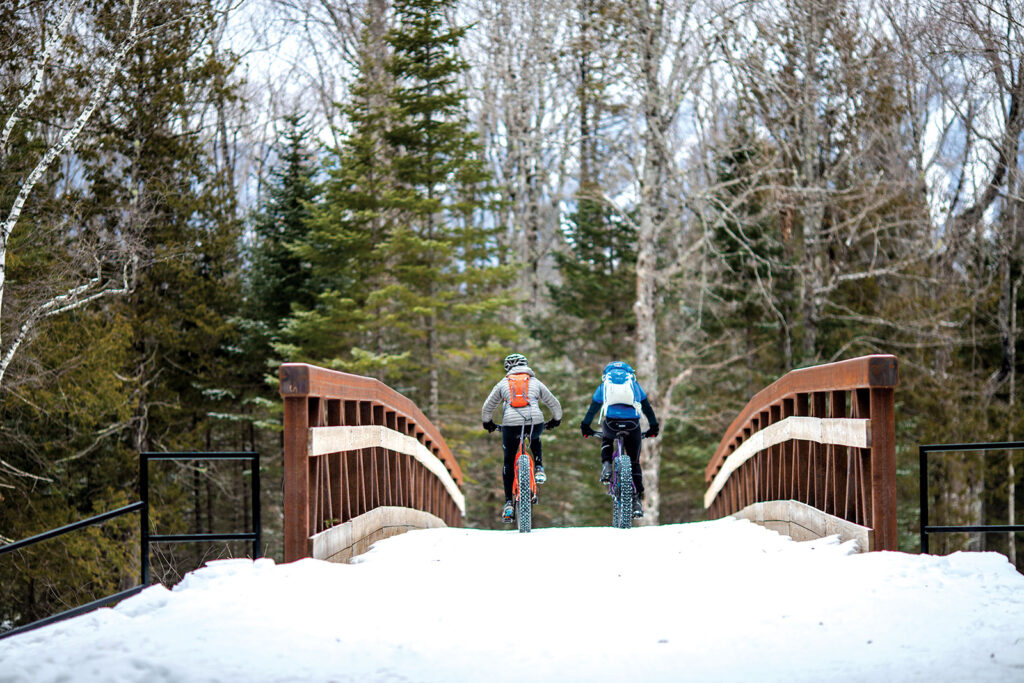
On the trail
fat Biking
If you love mountain biking and winter, fat biking might be your new favorite sport. Fat bikes use huge, grippy tires that allow riders to take to trails typically used by snowmobilers and cross-country skiers.
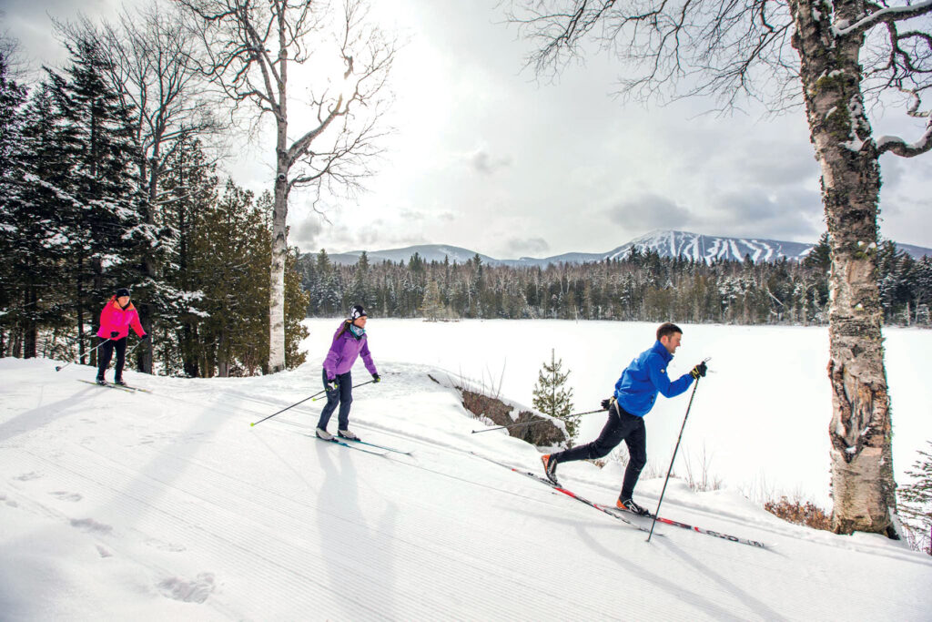
On the trail
Nordic Skiing
On a crisp, sparkling winter day, one of the best ways to take in Maine’s Lakes and Mountains snowy landscape is to venture out on cross-country skis.
On the trail
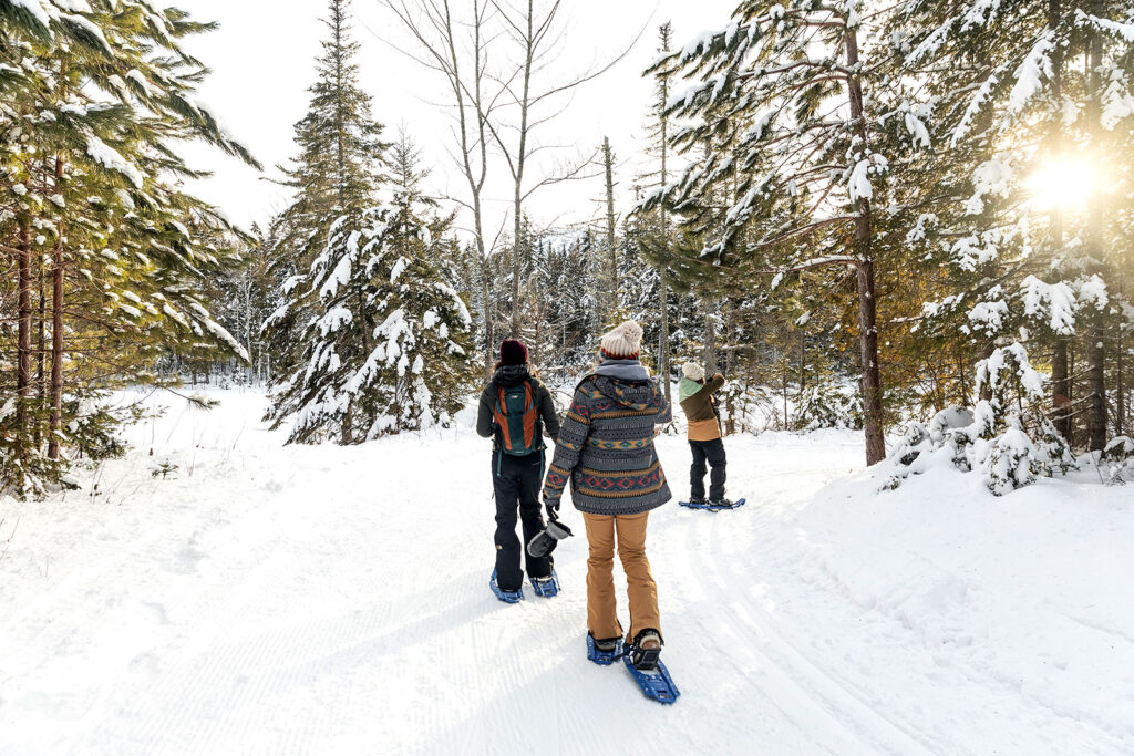
snowshoeing
Snowshoeing enthusiasts have options lots of options here. With over 250-miles of groomed trails across the region
On the trail
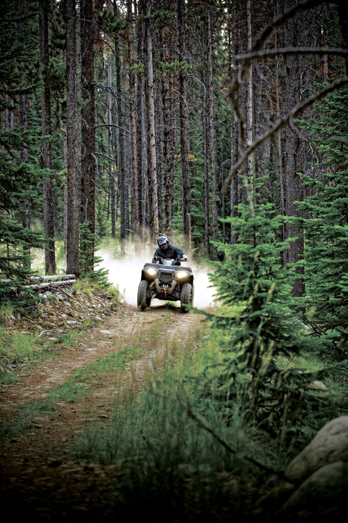
ATV Riding
Take on terrain from rocky climbs up a mountain, to smooth cruises through open plains as you explore extensive miles of ATV trails spanning mountains, forests, and meadows.
On the trail
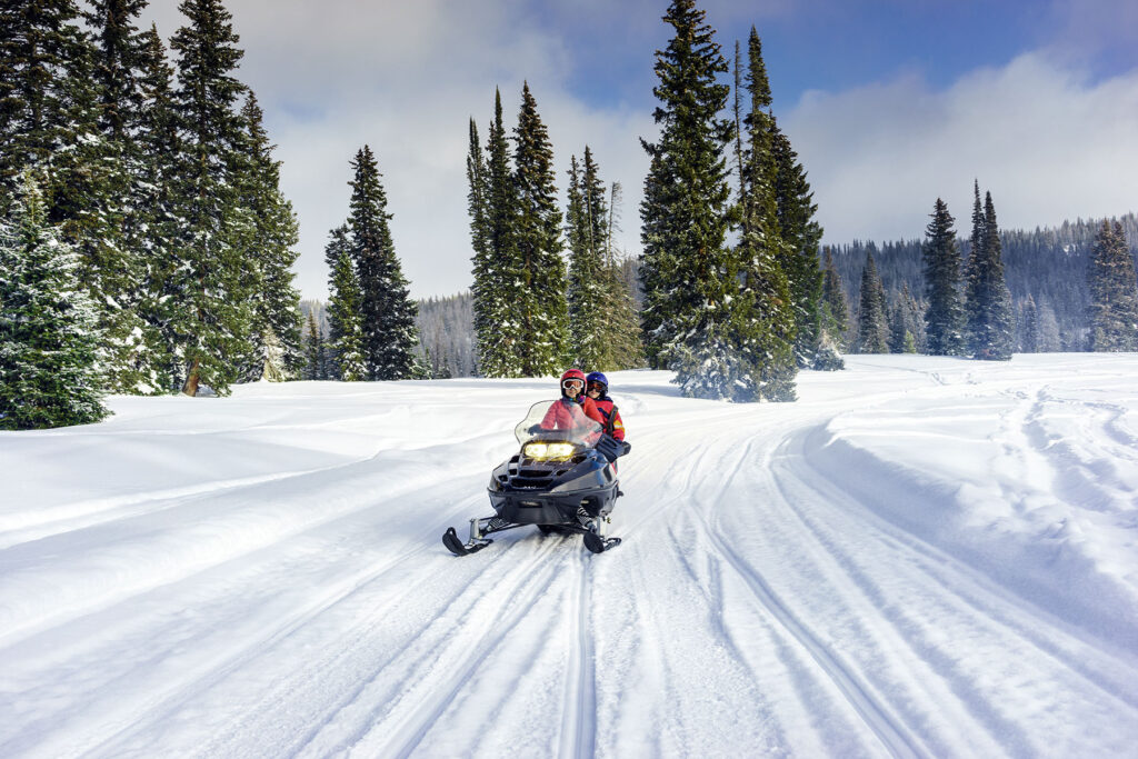
snowmobiling
With over near-endless miles of groomed trails maintained by local riding clubs, you’ll always find new places to explore amid the incredible scenery, fragrant pine forests, and wide-open plains.
Nature and Wildlife
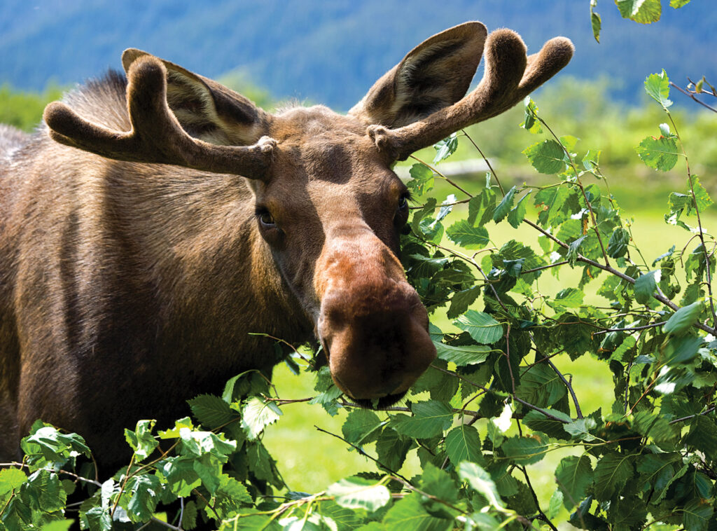
Moose Spotting
You can spot moose throughout most of Maine, but their population is most significant in more secluded areas, including much of Maine’s Lakes and Mountains.
Nature and Wildlife
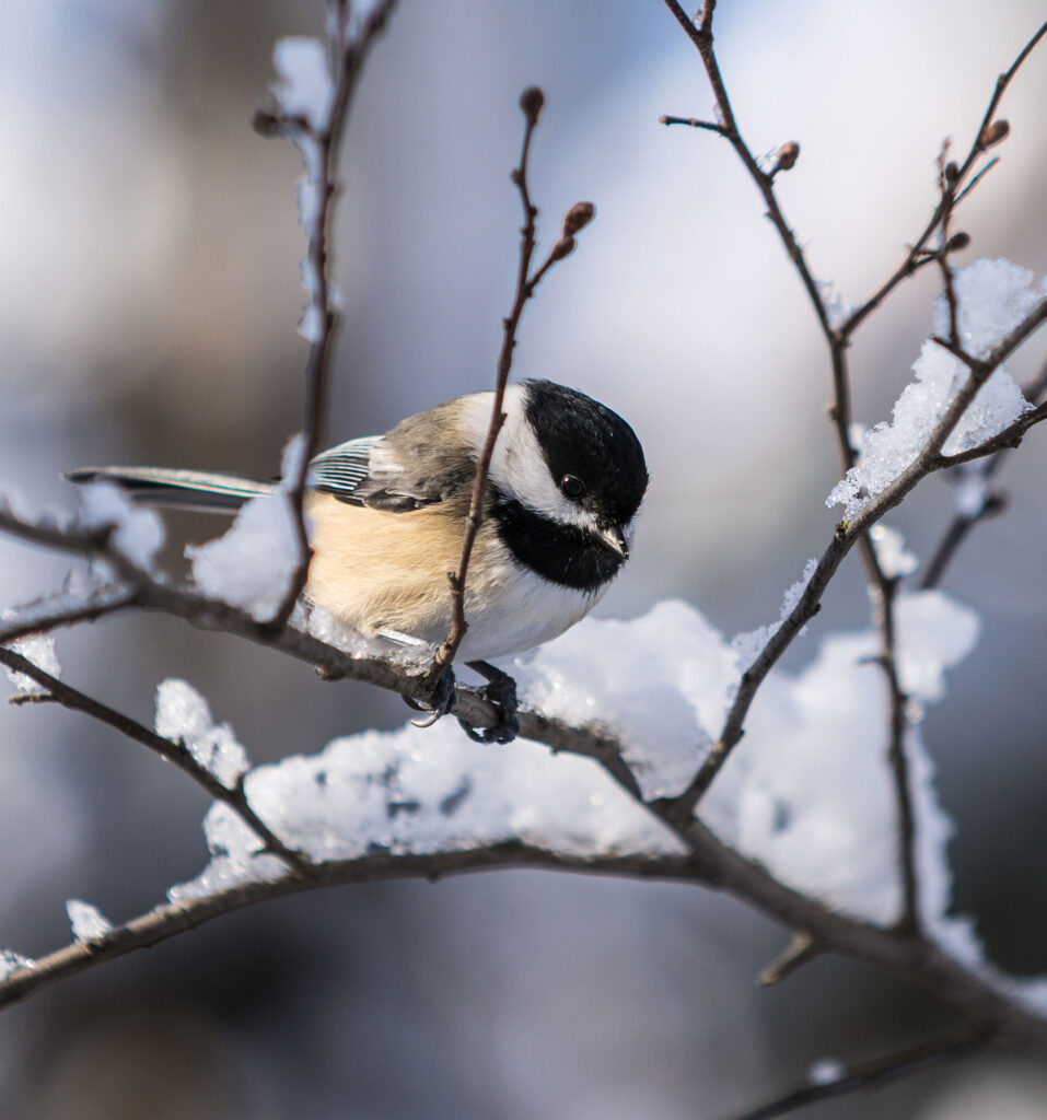
birding
The forests, fields, and wetlands of Maine’s Lakes and Mountains are the ideal setting to experience the thrill of birdwatching. Many highly coveted species can be found in the area’s boreal forests, including woodpeckers and Bicknell’s Thrush.
Plan Your Trip
Maine’s Lakes and Mountains offers a variety of resources to help you plan your next visit, including an annual visitor’s guide, stand alone map, and the new Adventure Guide App.
Visitor's Guide
Our Free Visitor's Guide will help inspire your next adventure along our mountain trails, lakes, scenic byways, bustling towns and more.
Map of the Region
Companion to the Visitor Guide, our dual-sided planning map will help you find your way to adventure in every season throughout the region.
Adventure Guide App
The App will point the way to all kinds of adventures, experiences and destinations in Maine’s Lakes and Mountains with GPS location maps and alerts.