Scenic Byways Trip
With its wild landscapes, pristine lakes, and rocky mountains, Maine inspires you to just hop in the car and set out on an adventure. When fall arrives, orange, gold, and red forests surround the state’s highways and byways, creating a brilliant backdrop to your drives.
Home of one of the oldest scenic byway programs in America, Maine offers many attractive drives that showcase the state’s impressive scenery, take travelers through charming small towns, and reveal some of the state’s interesting history. While traveling many of these roadways, there are opportunities to get closer to nature by camping, hiking, or enjoying a picnic. If you’re itching for a road trip, don’t miss these four scenic drives in western Maine.
Rangeley Lakes National Scenic Byway
Start: Route 17, Rumford
End: Route 4, Madrid
Length: 35.6 miles
Travel Time: 2.5 hours (without stops)
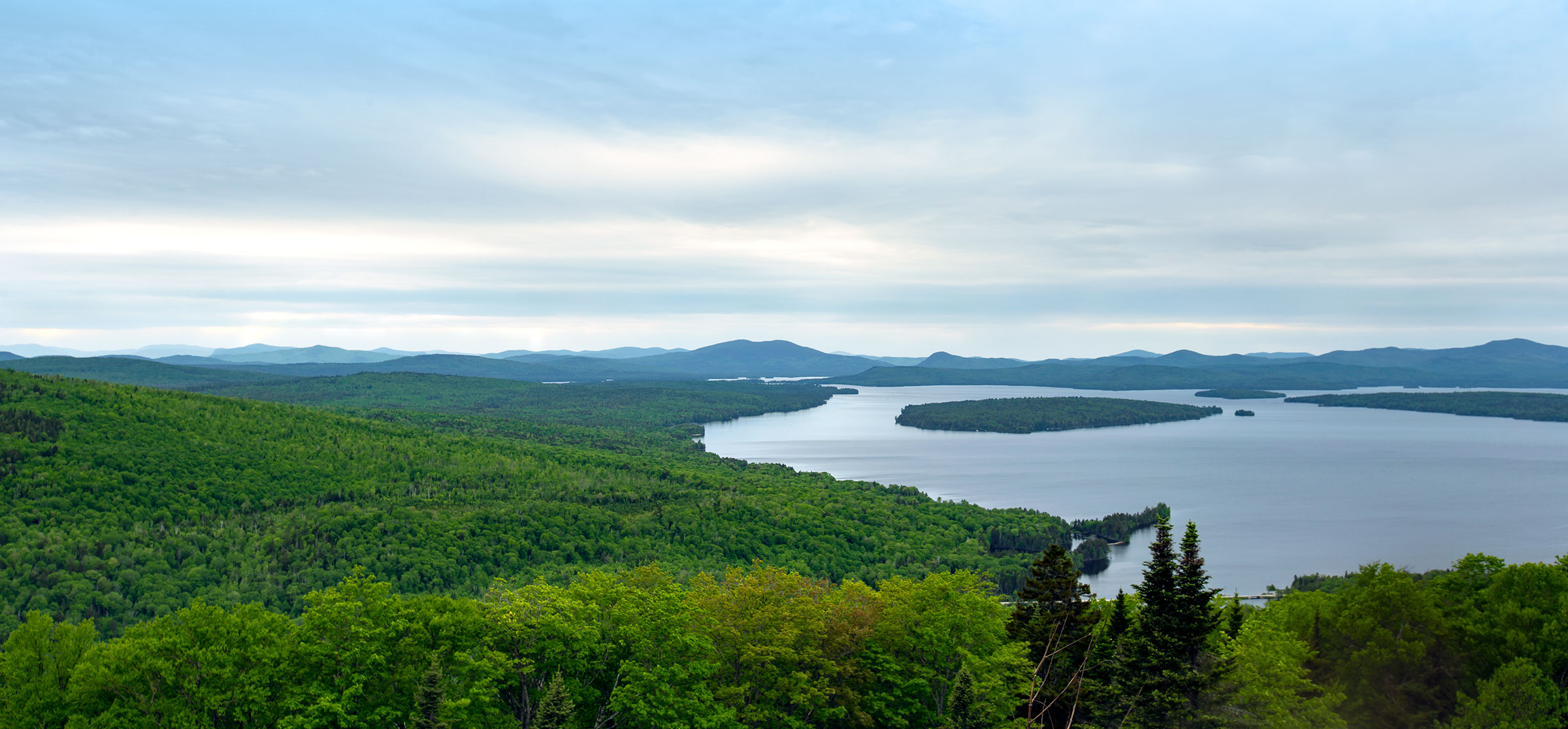
On this journey along Route 4 and Route 17, you’ll encounter high mountain lookouts, sparkling blue lakes, and dense forests. Take time to pull off at the road’s apex, Height of Land on Route 17, to see a wilderness overlook lauded as one of New England’s best. One of Maine’s ten largest lakes, Mooselookmeguntic Lake—and its Toothaker Island—are set front and center with mountains, creating a spectacular backdrop in any season, but especially when fall leaves peak.
Stop in the tiny town of Oquossoc at the junction of Route 17 and Route 4 to explore the historic Oquossoc Log Church, built out of spruce logs in 1916. Then, cruise to the route’s namesake resort town for year-round recreation amidst mountain and lake vistas.
At the route’s end, stop at Smalls Falls, which flows into a large pool surrounded by colorful cliffs.
Get Outdoors: Coos Canyon
Take a break from the drive at the Coos Canyon rest area, where walking paths, swimming holes, and waterfalls offer a welcome respite from the road.
Grafton Notch Scenic Byway
Start: Route 26, Newry
End: Route 26, Upton
Length: 21 miles
Travel Time: 3 hours
Find top-notch leaf peeping on this state scenic byway beginning in the town of Newry near Sunday River Ski Area. The colorful scenery continues as you follow the Bear River for most of its 21-mile journey. The route wows with views of waterfalls, the Mahoosuc Mountain Range, Grafton Notch State Park, and Lake Umbagog.
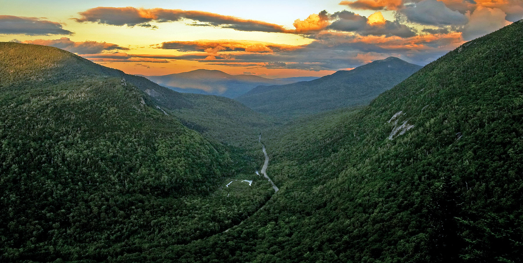
Make your first stop just south of Newry at one of Maine’s most photographed covered bridges, Sunday River Bridge, a historic structure dating to 1872. Continue along to a 1,000-foot gorge where the Bear River cascades down 100 feet to form Mother Walker Falls. Drive north to see Appalachian Trail hikers’ favorite view, Grafton Notch. A glacier cut this mountain pass nearly 12,000 years ago, and the section is said to be the most challenging of the 2,200-mile Appalachian Trail.
Get Outdoors: Screw Auger Falls
A short walk from the roadway, you’ll find Screw Auger Falls, where the water twists as it drops 23 feet through a chute. The slippery setting can be dangerous for kids, so don’t leave them unattended.
Maine High Peaks Scenic Byway
Start: Route 27, Kingfield
End: Route 27, Coburn Gore
Length: 47 miles
Travel Time: 1.5 hours
Featuring historic towns, rushing rivers, and high mountain peaks, this scenic byway is spectacular to drive year-round. Route 27 begins in the quaint town of Kingfield and runs adjacent to the Carrabassett River before connecting to the towns of Eustis, Stratton, and Sugarloaf Resort—Maine’s largest ski mountain.
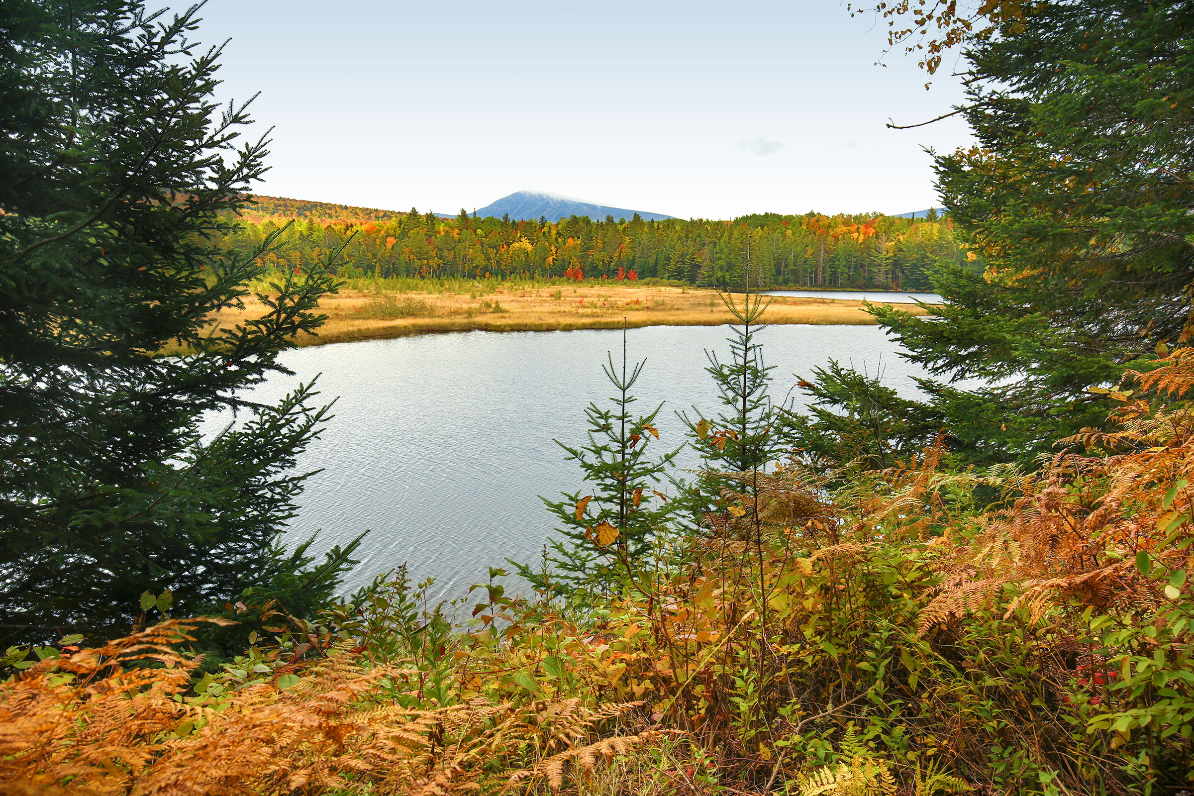
Continue winding up Route 27 for views of Mount Abraham, the Bigelow Range, and manmade Flagstaff Lake as the landscape grows wilder and more remote. Stop at Cathedral Pines, the state’s largest stand of old-growth red pines, and a series of interconnected ponds called the Chain of Ponds. End in the tiny township of Coburn Gore, Maine, on the Canadian border.
Get Outdoors: Chain of Ponds
Stop to kayak or fish at this set of five linked ponds located right on Route 27. Make it an overnight trip with a stay at the area’s private campground. Sarampus Falls rest stop is also a great place to stop for a picnic or quick hike.
pequawket trail scenic byway
Start: Route 113/5, Standish
End: Route 113, Gilead
Length: 60 miles
Travel Time: 2 hours (without stops)
Named for the native Sokokis tribe that lived in this river valley, the Pequawket Trail Scenic Byway snakes along the Saco River in the shadow of the White Mountains and connects the towns of Standish, Fryeburg, and Evans Notch as it weaves in and out of New Hampshire.
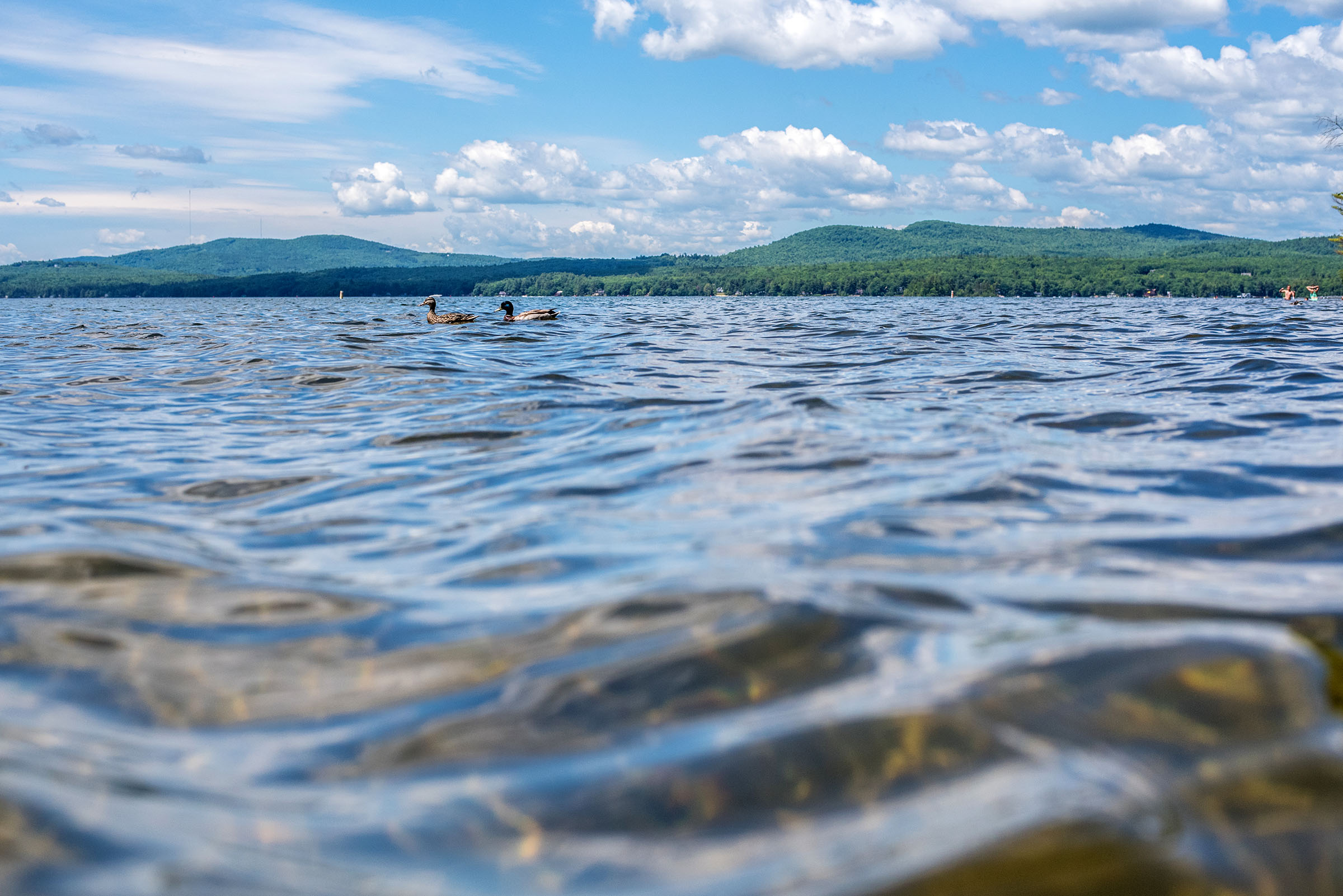
Take a driving break at Hiram Falls, a roadside stop with a sandy beach at the foot of a hydroelectric dam. Swimming, fishing, and kayaking are popular pursuits on the Saco River, which runs right along the byway.
Flaming fall leaves paired with White Mountain panoramas make the Byway most stunning in September and October. Due to snow, the White Mountain National Forest section between North Chatham and Gilead closes during winter.
Get Outdoors: Burnt Meadow Mountain
For epic vistas of New Hampshire’s White Mountains beyond the byway, stop in Brownfield to summit Burnt Meadow Mountain on a 2.4-mile trail by the same name.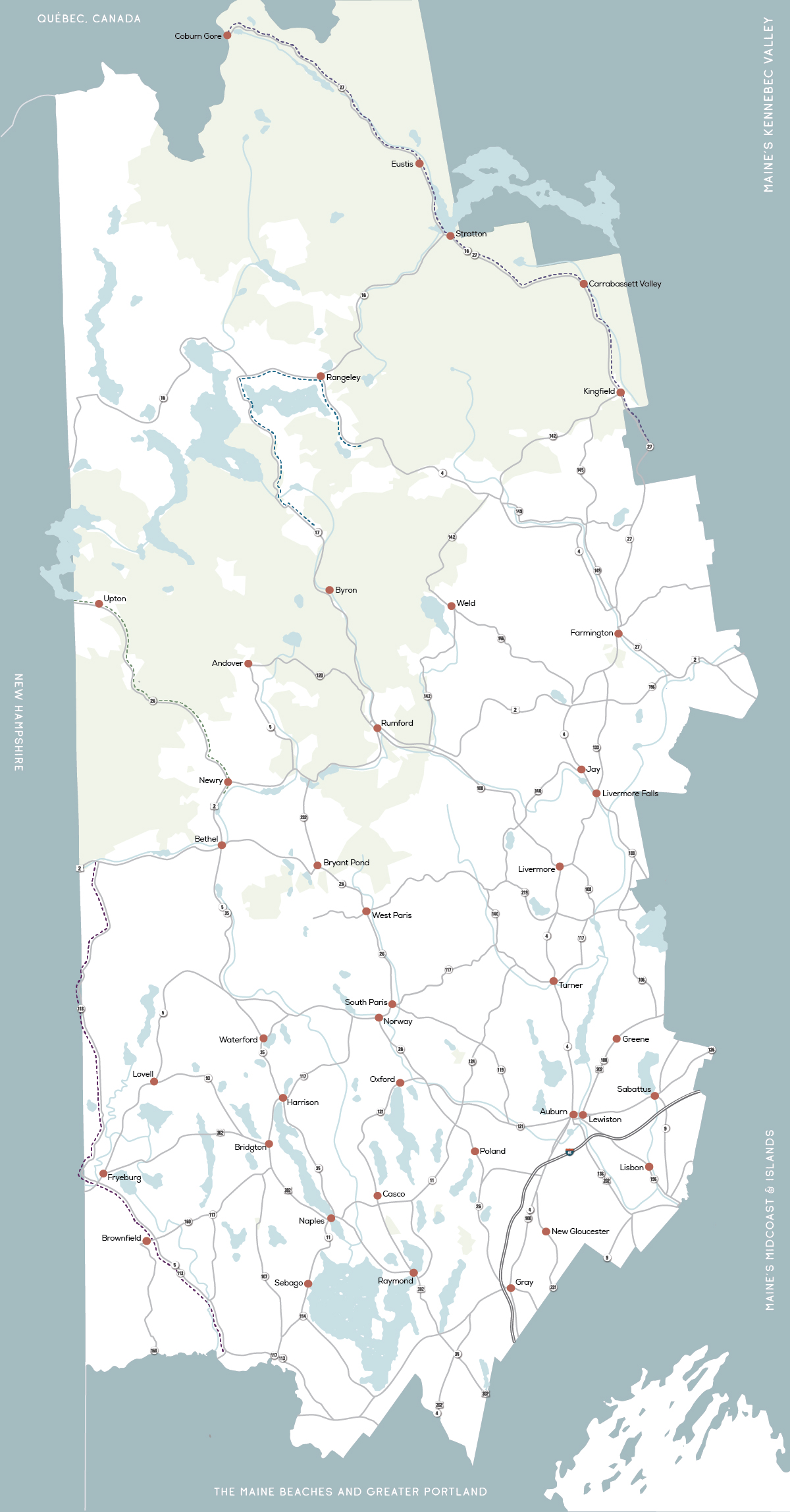
Based in part on content originally written by Jenny Willden for RootsRated in partnership with Maine’s Lakes and Mountains Tourism Council.
Plan Your Trip
Maine’s Lakes and Mountains offers a variety of resources to help you plan your next visit, including an annual visitor’s guide, stand alone map, and the new Adventure Guide App.
Visitor's Guide
Our Free Visitor's Guide will help inspire your next adventure along our mountain trails, lakes, scenic byways, bustling towns and more.
Map of the Region
Companion to the Visitor Guide, our dual-sided planning map will help you find your way to adventure in every season throughout the region.
Adventure Guide App
The App will point the way to all kinds of adventures, experiences and destinations in Maine’s Lakes and Mountains with GPS location maps and alerts.