With six total, the Maine’s Lakes and Mountains region is home to more covered bridges than any other part of the state. Once, there were 120 covered bridges in Maine, but because of fire, flood, ice, progress, and the Great Freshet of 1896, nine are all that remain in the state.
Once the only way to get there from here, covered bridges offer visitors a glimpse into our past. Between the mid-1800s and early 1900s, covered bridges appeared over Maine’s mighty rivers, allowing travelers in horse-drawn carriages to forge rivers without getting swept downstream. These wooden structures had roofs added to protect them from the elements, and had it not been for the “covers” over these bridges, the wood would have rotted and slowly disintegrated.
tour our covered bridges
Babb's Bridge
The oldest of Maine’s covered bridges, Babb’s Bridge was originally built in 1840 to span the Presumpscot River between Gorham and Windham. The original bridge was destroyed by fire in 1973. Using lumber milled locally, a replica was constructed with queen-post trusses built using historically accurate techniques. The bridge was re-opened to traffic three years later.
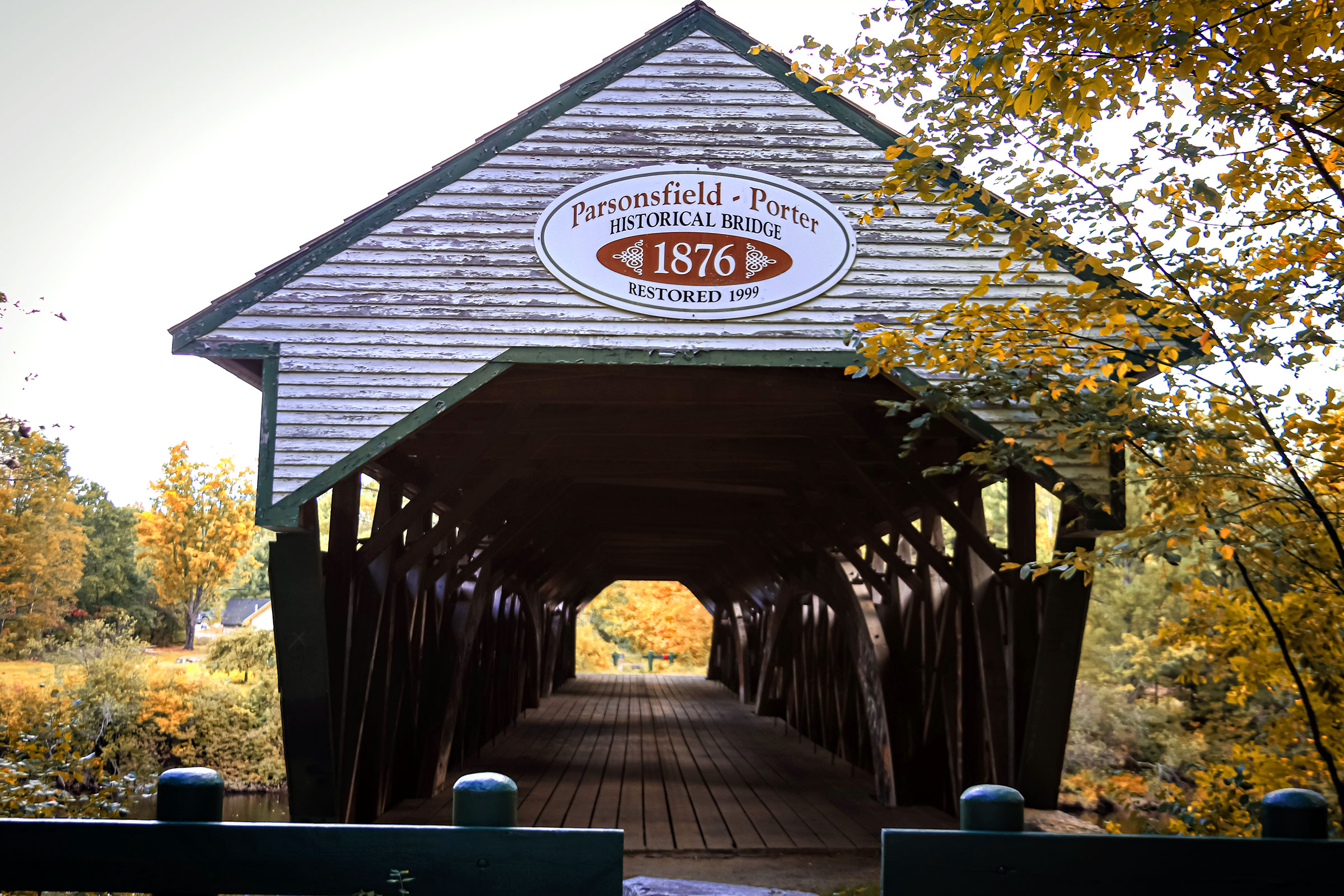
Parsonsfield-Porter Bridge
The Parsonsfield-Porter Bridge was built over the Ossipee River along Kezar Mountain Rd. in 1859 by a combined effort of the towns of Parsonfield and Porter.
The 152-foot structure is of Paddleford construction, strengthened with laminated wooded arches. The bridge, located one-half mile south of Porter, was closed to traffic in 1960 when a new bridge was built upstream.
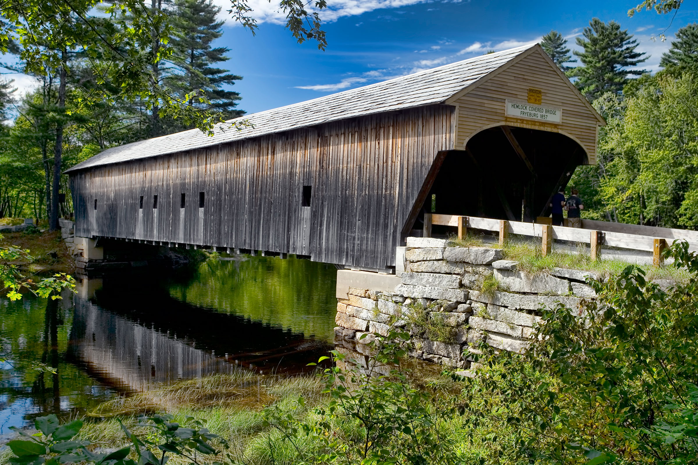
Hemlock Bridge
Hemlock Bridge, built in 1857and reinforced to carry local traffic in 1988, is a 109-foot Paddleford truss bridge strengthened with laminated wood arches. It was built on granite abutments since it was located in an active floodplain over the Saco River.
The bridge was designated as a Maine Historic Civil Engineering Landmark by the American Society of Civil Engineers in 2002.
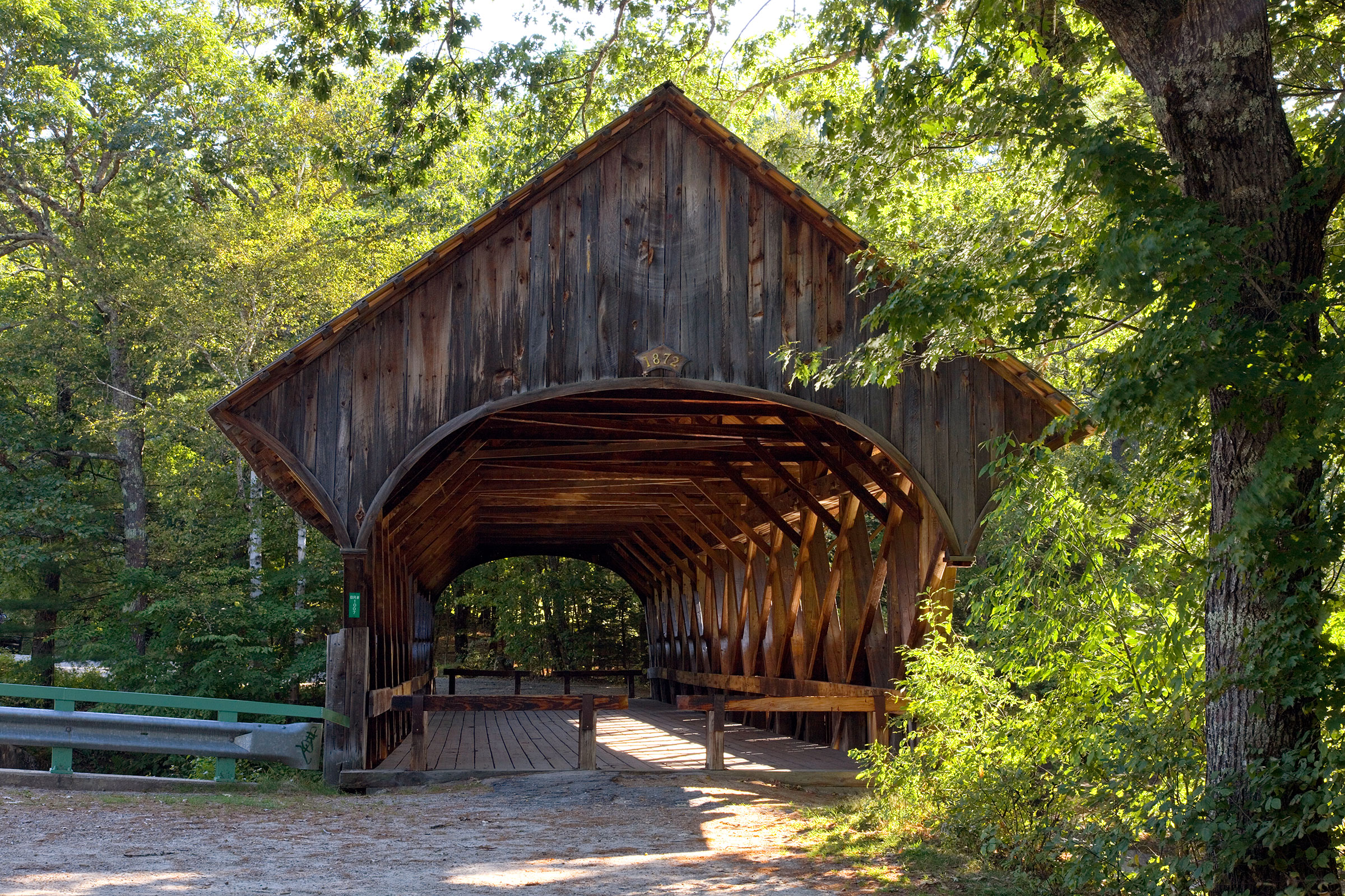
The Artist's Bridge
Also known as the Sunday River Bridge, The Artist’s Bridge is Maine’s most photographed, painted, covered bridge. Some say that a local family began calling it such because the artist John Enncking was observed working by the bridge on many days.
The 87-foot Paddleford Truss bridge was closed to traffic in 1958 when a new bridge was built downstream.
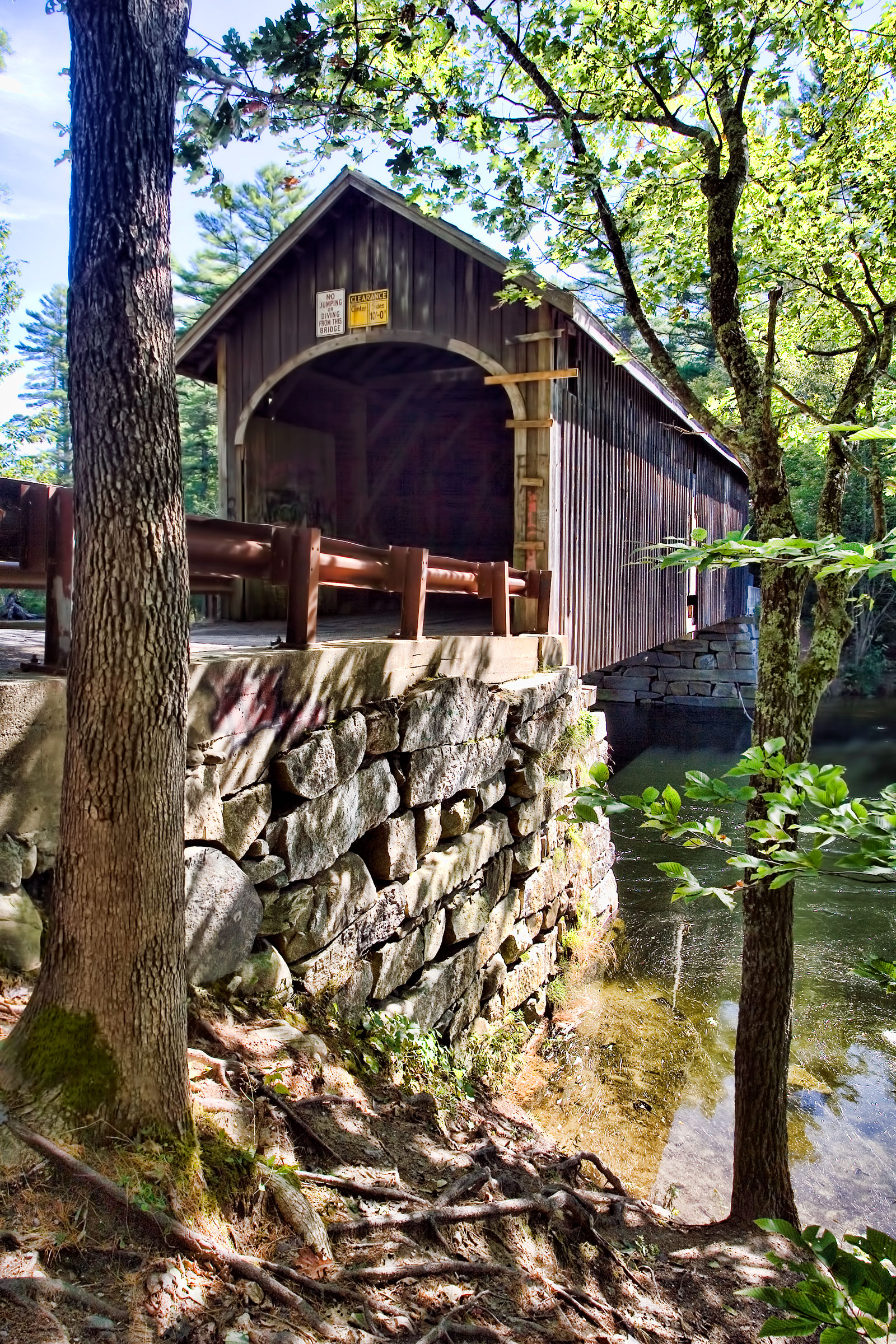
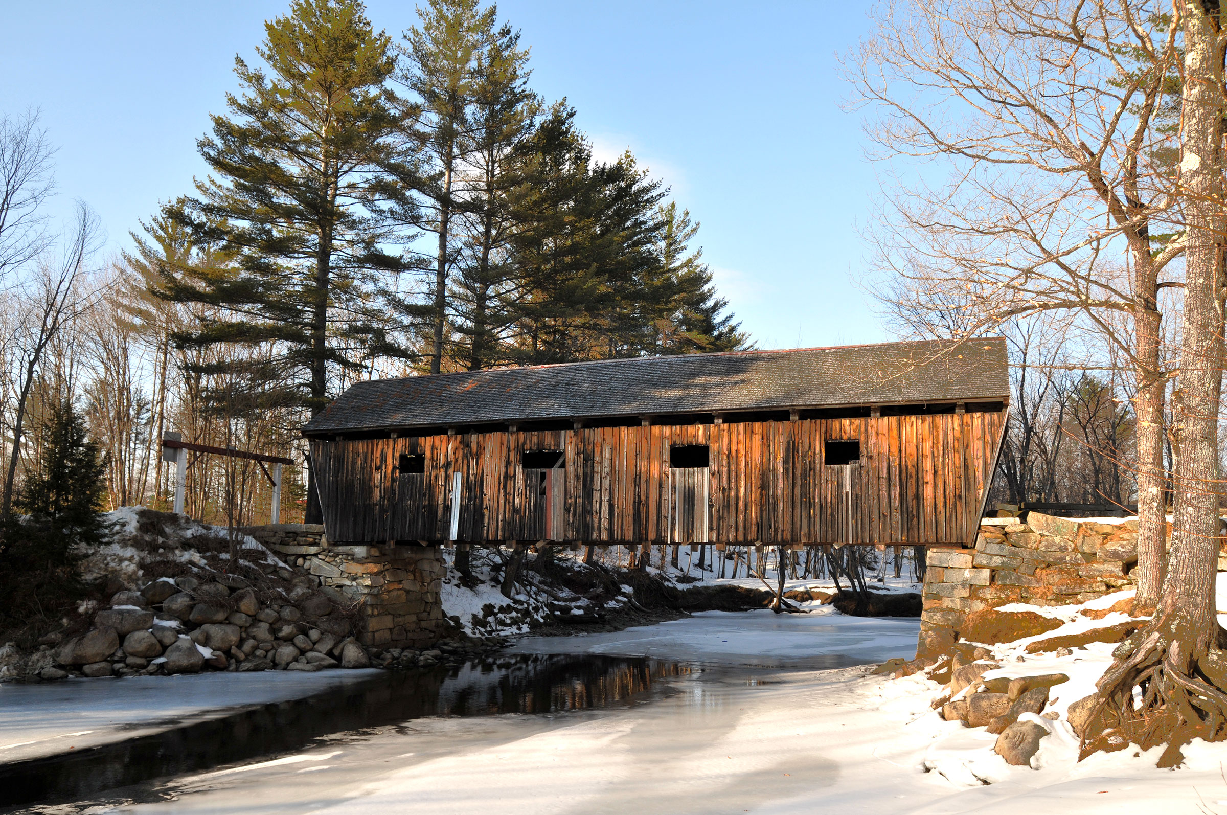
Bennett Bridge
Also referred to as the Bennet-Bean Bridge, this 93-foot-long bridge spans the Magalloway River near Wilson’s Mills and Lincoln Plantation. Built in the early 1900s with Paddleford trusses, it is an ideal spot to take pictures throughout the year, though it is especially lovely surrounded by Autumn foliage. Used for years by logging trucks and farmers, the bridge was finally closed to traffic in 1985.
Lovejoy Bridge
This 70-foot bridge, built in 1868, spans the Ellis River in South Andover. Constructed of Paddleford trusses, it is Maine’s shortest covered bridge. Its name comes from the Lovejoy house on the eastern side of the river.
In 1983, a heavy sand truck fell through the bridge’s deck while trying to cross the span. Following that incident, the bridge was reinforced in 1984 to carry local traffic.
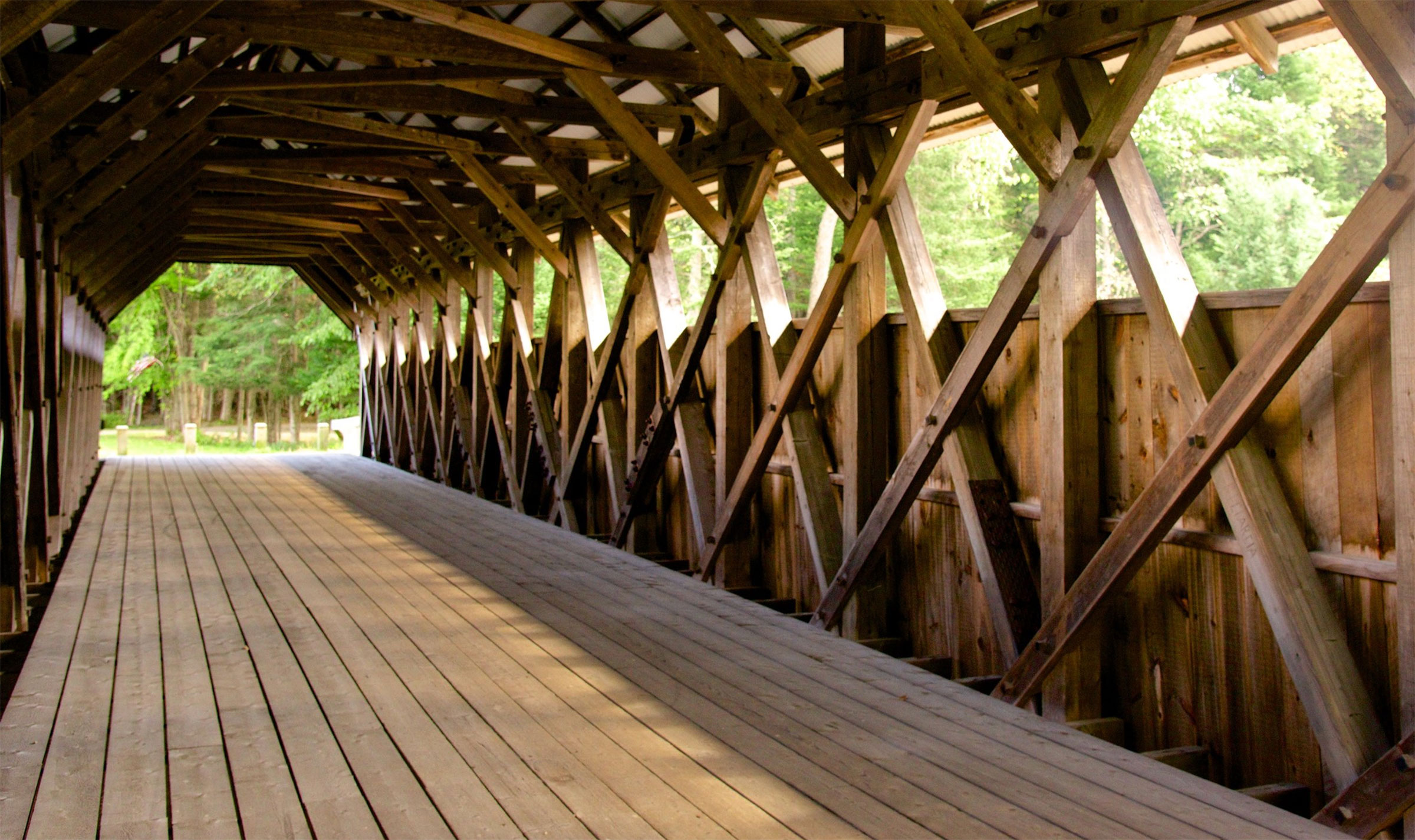
glossary of Covered Bridge Terms
Abutment: abutments support the bridge at each shore of a stream.
Bridge Deck: the roadway through the bridge.
Buttress: timbers or iron rods placed along the outside of a bridge and connected to the floor beams, and the top of the truss-work.
Kingpost: the vertical wooden post hung from the apex of the main diagonal braces. The standing member is paired with one or two diagonal braces in a multiple-Kingpost truss.
Queenpost: this truss style forms an elongated, topless triangle with support posts at each end. Also, a simple design allows for longer bridges than the kingpost.
Paddleford Truss: a bridge builder from Littleton, New Hampshire, Peter Paddleford created his truss style by modifying the Long truss, stiffening it with a system of interlocking counterbraces.
Portal is a general term for the entrance of a covered bridge.
Post: upright or vertical timbers in a bridge truss.
Treenails: pronounced “trunnels.” they are wooden pins driven into the holes drilled into the plank members of a lattice truss to fasten them together.
ways to adventure
Eat and Drink
Dining
There are great places to eat around every turn. You’ll find exactly what you’re craving; whether it’s iconic Maine lobster with drawn butter or an espresso coupled with a chocolate croissant
The cities and towns in Maine’s Lakes and Mountains, places of discovery, are home to an eclectic collection of art, cultural, science, and living history museums.
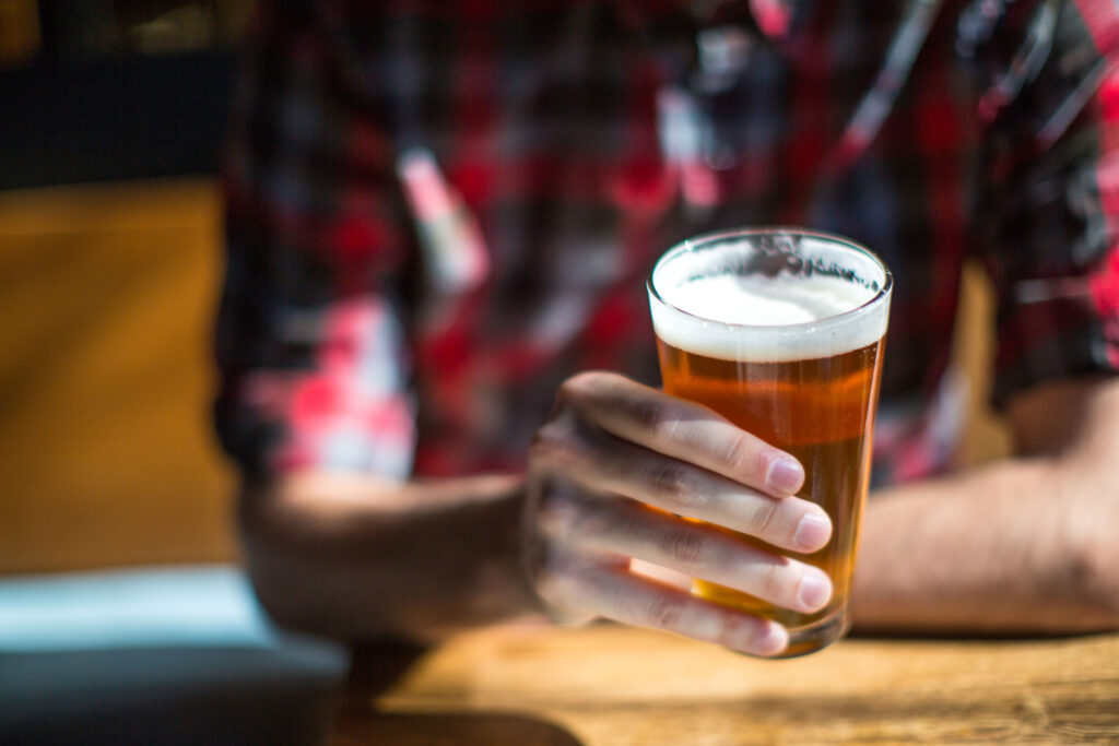
With hundreds (maybe thousands) of miles of hiking, biking, and ski trails and just as many watering holes, Maine’s Lakes and Mountains has welcomed the national craft beer love affair with open arms.
Discover a collection of performing arts events that take place throughout the year, from modern and avante-garde dance and equity theater to juggling in a converted barn.
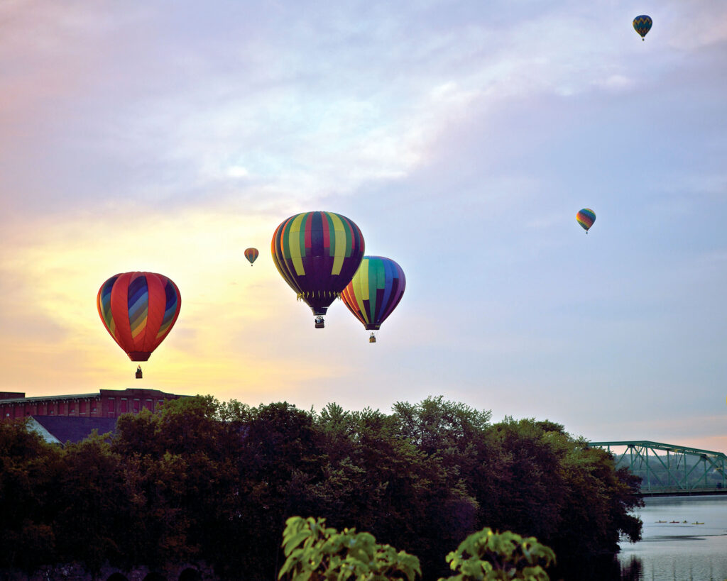
Maine’s Lakes and Mountains is filled with events year-round. Food festivals, concerts and dance, hot air balloons and tough mudders, are all here to delight and enthrall visitors.
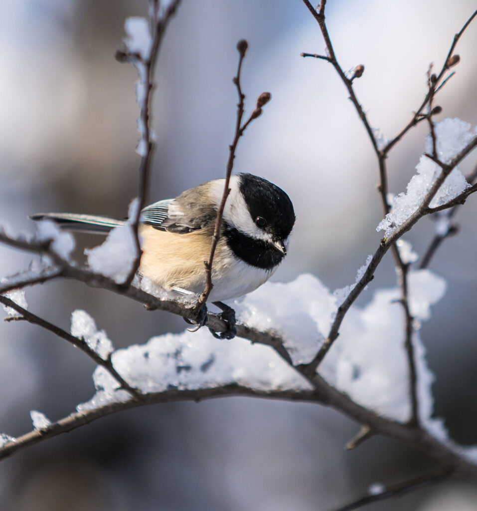
The forests, fields, and wetlands of Maine’s Lakes and Mountains are the ideal setting to experience the thrill of birdwatching. Many highly coveted species can be found in the area’s boreal forests, including woodpeckers and Bicknell’s Thrush.
Maine’s Lakes and Mountains offers a variety of resources to help you plan your next visit, including an annual visitor’s guide, stand alone map, and the new Adventure Guide App.
Visitor's Guide
Our Free Visitor's Guide will help inspire your next adventure along our mountain trails, lakes, scenic byways, bustling towns and more.